tasting wine in el Bierzo

after weeks of consuming the house wines offered by albergues, drinking out of a fountain on the side of a winery, and tramping through acres and acres of vineyard all across northern Spain, we got around to tasting at a bodega (wine cave, basically) on day 26. up until this point, we hadn’t much opportunity to do anything resembling a tasting like those so common around the U.S. I wouldn’t be surprised if wineries in the more traditionally tourist-friendly areas did those types of tastings but when you’re going everywhere on your own bipedal power there’s no real “short side trip” to do anything, much less taste wine.

while Rioja is perhaps better known as a wine-producing region in Spain (at least by me prior to this trip), el Bierzo also has exceptional vine-growing soil and its own thriving wine industry. prior to the arrival of Romans, the region was populated by the Hispano-Celtic Astures people who shared origins with the people of Galicia. while agriculture and an assortment of vines came to el Bierzo with the Roman Empire, it wasn’t until the Middle Ages and expansion of monasteries (primarily those of the Cistercians) that wine production took off. the industry was nearly obliterated in at the end of the 19th century as a result of a phylloxera plague that destroyed nearly all the vineyards in the region (as well as most of those in Europe, actually, thanks to over-eager British botanists who inadvertently brought the aphids back to Europe on North American vines). the economy of el Bierzo suffered greatly as a result and it took decades of cultivating hybridized vines before wine production regained its level of importance; its doing quite well today and in 1989 received the Denominación de Origen designation.

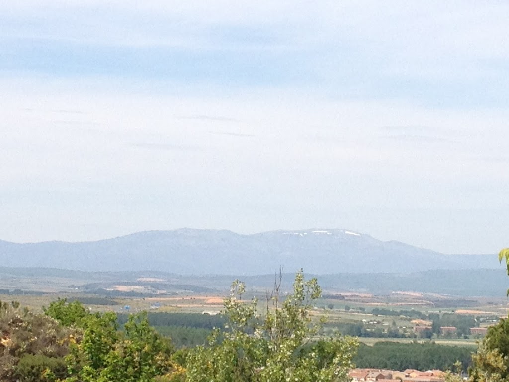
as far as cultivating grapes, el Bierzo shares useful climate elements with both Galicia and Castilla. levels of rainfall and humidity are similar to Galicia, as are the generally mild winters and late frosts. summers are more similar to Castilla — hot and dry. temperatures reach 22 degrees Celsius (about 71 Fahrenheit) during July and August while the annual average temperature is about 12.5 Celsius (or 54 Fahrenheit). the soil comprises mostly shale and clay and is slightly acidic and the Mencia and Grenache are the most common red grape varieties while Godello makes the most popular white wines of el Bierzo.

as we walked through Cacabelos, we passed the Cuatro Pasos bodega. we stopped in to taste and “tour” their wines (though all from the front room rather than wandering about the cellars) and help the “guide” practice her English. that proved fortuitous as her English was unquestionably better than my Spanish, particularly in a setting that involved words beyond my vocabulary range. she took us through their four wines and gave us the origin story for the winery; the name stems from a set of four bear paw prints the owner spied early one morning while out checking on vines. after tasting all four options, we concurred that we preferred the only wine not available for sale outside of Spain — from a rarer grape that produced a smaller yield and therefore meant fewer bottles produced each year. we certainly had no intention of carrying a bottle of wine with us for the remaining 180 or so kilometers and, as we subsequently discovered, wouldn’t have been able to ship any to ourselves before leaving Spain, anyway. in the end, perhaps that was for the best; we certainly learned more about our preferences as they pertain to Spanish wines!

Astorga — convergence of roads

at the outset of the Camino, our stay in Astorga was one of the things to which I was most excited: I’d found a five-star spa/hotel to help soothe what I anticipated might prove dastardly aches and pains. unfortunately, shifting our itinerary to take a day of rest in León meant arriving in Astorga on a Monday — the only day the spa didn’t operate. could have been a tragedy if the bed hadn’t proven so fantastically, magically comfortable. and they gave us bathrobes and slippers to use, as one might expect a spa/hotel might do. it makes me smile just thinking about it.

not only did the day of rest in León give us a boost of energy kicking off the day to Astorga, the fabulous breakfast and knowledge we had a comfortable room booked for the night made the hike that much more tolerable. we arrived with time and energy to spare and got a good look around town before burrowing into the bed for a(nother) good night’s sleep.

foremost, Astorga is a crossroads; two major Camino routes converge here — the Camino Frances, the Via de la Plata from the south — as well as the Calzada Romana from Rome and other major trade routes. it’s strategic importance dates from the Asturians (a Celtic people) that pre-dated settlement by the Romans. preserved Roman baths and a museum explaining the city’s heritage stood between the first albergue and our hotel — one of the first things you see as you enter the city on top of the hill. the city walls are (in part) of Roman construction. during Roman times, the city functioned largely to protect the roads, especially the one that headed to precious metal mines in the surrounding mountains. (our map noted several mine ruins — all of which seemed way too far off the Camino on day 22 to even consider venturing towards for investigation.)

because of the converging roads, nearby mines, and proximity to Santiago, Astorga became important for early Christianity in the Iberian peninsula; one of the first three bishoprics of Spain was established here before the 3rd century and the title of the officeholder is one of the oldest religious titles in Europe. rumor contends that both St. Paul and Santiago preached in Astorga at some point.

after the re-conquest, Ordoño I fortified the city and emphasized it as a Christian stronghold; it remained un-raided during the 10th century wars to the east consequently became the de facto capital of León. the following centuries saw Camino-driven prosperity and trade. the city declined somewhat with the tapering off of peregrinos but continued prosper because of its location; in addition to all manner of other goods and treasures it acted as the royal drove road for livestock going virtually anywhere in the Iberian peninsula. no wonder it’s thrived so long — it had way more than the presence and demands of peregrinos to keep it humming.

León – a history of a city

as befits a still-grand city, León’s origins date from the Romans who established a military outpost here in the year 70 to protect gold mines and it later became the seat of the VIIth Legion and capital of the empire in northwest Spain. a massive wall, remains of which still mark the limits of the old town, encompassed the Roman settlement. that wall, along with some baths under the cathedral are the only structures that remain from that period.

fortunes in the city ebbed and flowed with the decline of the Romans, incorporation into the kingdom of Asturias, conquest by the Visigoths (in 585), and then the Moors (712) under whose control it remained for over a century. in 746, Ordoño I managed to extricate the city from Moorish control and his successors invited Mozarabic refugees (Christians who hadn’t fled their lands and chose to remain under Moorish rule) from farther south to repopulate the city. despite the success of Ordoño and his immediate successors in building León up as a Christian city (and transforming the Kingdom of Asturias into that of León) — establishing churches, granting land to the bishop to construct a cathedral over the Roman baths, relocating the Asturian court and building a royal palace — subsequent generations proved weaker-willed and in the 10th century monarchs were paying protection money to caliphs in Cordoba to maintain “peace.” evidence of the 10th century prosperity vanished in 988 when the king, seeking aid from his “protectors” to defeat a rebellious brother, essentially invited an attack and occupation. in the 11th century, Alfonso V began a successful campaign to wrest control of Spain from Moorish control and his success led to eventual unification of the Castillian and Leonese crowns (as discussed in a previous post). by the middle of the 14th century, however, economic and political activity had shifted elsewhere as more and more of Spain fell under Christian authority. a series of continent-wide cataclysms, culminating in the arrival of the bubonic plague in 1349 or 1350 decimated León and effectively stunted its importance and growth for several centuries.

population growth stagnated until 19th century; most of the increase came down to influx from surrounding farming communities after the arrival of the railroad in the 1860s, in search of alternative means of employment. throughout the 20th century the population of the city grew rapidly — from about 21,000 inhabitants in 1920 to a peak of over 147,000 in 1995 — still due primarily to rural exodus.

the Leonese language is considered extremely endangered (more nearly extinct) by UNESCO, though the movement to attain Leonese autonomy from Castilla has made an effort to revive it. in 2006, the provincial government approved a Leonese Language Day as advocated for by a variety of language associations. as we proceeded farther along the Camino and away from Castillian influence we saw more and more graffiti promoting independence for León. I assumed the ” Llión Solo” signs we saw stemmed from an autonomy movement like the one in the Basque country, but hadn’t any confirmation of that until now. the University of León established a teacher training course in the Leonese language in 2001 and there are both adult-education courses in the language and lessons at high schools around León.

it seems like León has a good history of protest and procession (you know, like events during Semana Santa) (maybe it’s just a Spanish and/or European thing to go out for a protest of a Saturday?); there was a notable rebel population here during the Franco regime, though a failed attempt at fomenting popular unrest resulted in the arrest and execution of a number of rebel organizers in 1936. when we were out at lunchtime in Saturday, a clump of bicyclers and pedestrian-types streamed past us down the middle of a major road –led by a police vehicle as often happens in the U.S. with permit-holding protesters, headed farther into town to join some kind of protest. based on the protest attendees in the plaza, it must have been something to do with cyclist and/or pedestrian safety and awareness.

Roman bridge at Cirauqui

crossing the Roman bridge

the hike between Puente la Reina and Estella was challenging — the temperature reached 26 degrees Celsius by the time we reached our destination and we had trouble finding lunch and a place to refill water during the day. we also learned what the sun can do to the back of a pair of legs if given motive and opportunity.

the name of this town — Cirauqui — means “nest of vipers” in the Basque language, alluding either to the snakes found among the rocks on this steep hill or bandits that roamed the hills nearby. the town grew in three stages beginning in the 9th century, and some of the nicer manor houses remain with familial crests above central doorways throughout town. one of the more interesting monuments in the town is the Civil War monument, which only lists victims on the Nationalist side (fighting for Francisco Franco). while many towns removed the ubiquitous monuments after Franco’s death, loyalty to the Falange movement that brought him to power remained strong in Navarra and in some places these memorials remain.

as the title of this post also alludes to, we climbed over a Roman bridge just outside of Cirauqui. while much of the Camino follows old an old Roman road, the path down the hill leaving Cirauqui and over this bridge are the best-preserved of the entire route, by far. granted, some of the paving stones were repaired or replaced during the Middle Ages, but the essence remains — and besides, a bridge from the Middle Ages is still a sight more impressive than anything I walk over on a daily basis. as our cultural guide explains, the method for constructing our modern roadbeds doesn’t differ much from those used by the Romans. a shallow trench is dug and filled with a layer of gravel, tamped down, bordered by large, vertically-set blocks, and filled in with closely-fit paving stones. it’s interesting to think that the workers digging out, marking off, filling in and paving over Trumpy Road near our house are following in the footsteps of the people (probably local slaves) that built this road and bridge thousands of miles and years away.

an “early Gothic” bridge that dates from “only” the medieval era

the walled city of Pamplona

of all the medium-to-large sized cities we walked through, nothing compared with the approach to Pamplona. it was damp during the last several kilometers, but not enough to properly be called “rain.” unlike later cities (looking at you, Burgos) the suburban sprawl to the east of Pamplona is limited and relatively picturesque. after crossing over the river, the walls of the city loom up suddenly behind the trees and demand a moment to take them in.

in 75-74 BCE, Pompey set up camp on the site of what is now Pamplona, establishing the village that over centuries grew into the city we see today. it later became the primary city of the Vascones (Basques), called Iruña. the intervening centuries saw the city controlled by all manner of rulers — Visigoths, Basques, Muslims. for a period after the Muslim conquest of Pamplona in 715, things remained stable as the Basques near the Pyrenees seemed disinterested in repulsing or ousting the Moorish troops and the city may have even flourished. as the 8th century progressed, however, control over Pamplona vacillated between Moorish and Frankish control with neither side able to gain satisfactory control. in 778 as he fled back towards the Pyrenees, Charlemagne is said to have destroyed the walls of the city (if not the entire city) in a bid, as mentioned, to prevent his enemies from using it in the future. this went counter to agreements he’d made not to attack the city walls and may have spurred Basque rebels into the ambush and battle that destroyed his rearguard in Roncevaux Pass.

city prospects revived again in the 11th century, helped by the flow of peregrinos along the Camino. the city enlarged with two additional boroughs in the 12th century — meaning three distinct (and often conflicting) towns existed within the city’s fortress walls. the king unified the boroughs into one city in 1423, which remained the capital of the autonomous kingdom of Navarra after its annexation to Spain in 1512. Castilian conquest a year later and advancements in military technology prompted enhancements to the city defenses, including the construction of a massive star for on the city’s south and fortification of the city walls. the walls we passed through date from the late 16th to 18th centuries. 


because of the city’s military importance, the walls restricted growth — expansion had to go up rather than out, resulting in tall buildings, warren-like streets, and a dearth of open spaces and courtyards. by the end of the 19th century, housing density reached a critical limit and modifications to the star fort allowed an expansion by six city blocks. woo! three decades later, however, the advent of the First World War and its attendant military advancements rendered Pamplona’s existing defenses useless and in short order the southern wall was demolished to allow for rapid urbanization and expansion from the 1920s to the 1950s and into the present day.


Pamplona is the home to the University of Navarra (ranked as the best private university in Spain and the campus of which we walked through on our way out of the city) as well as the infamous Opus Dei, which operates the University. city industry is diversified with the automotive industry making up the largest part. renewable energies are also increasing their presence in the economic sector — which is evinced by the line of wind turbines dotting the ridge to the west of the city (about which more in my next post). nearby Sarriguren is home to the National Centre for Renewable Energies.


and of course there’s the (in)famous running of the bulls every year in July during the Festival of San Fermín. can’t say I’m sad we missed it — there’s no way we would have gotten a room at our awesome hotel and would have had to contend with thousands of people while we made our way wearily out of town just as they’re releasing the bulls.

the Cathedral of Santiago and the origins of the Camino

I’ll start with a picture from our destination. 

after departing well before sunrise, using a headlamp to make our way through eucalyptus forest, getting lost for the first time on the entire journey, dodging ubiquitous city traffic, and getting stuck behind slow-moving, German day-trippers, we came through an archway, serenaded by a gaita (Galician bagpipes) and emerged into the Praza Obradoiro. the hulking Ayuntamiento de Santiago (government building) filled one side of the plaza and facing it stood the expansive Catedral de Santiago de Compostela, backlit by the bright mid-morning sunshine. though the architecture of Burgos might seem more impressive from the outside or the stained glass of Leon more impressive inside, neither could compare in the elation that arose while standing in the middle of the plaza looking up at the place we’d traveled 500 miles on foot to reach.

in a few words, the Catholic dimension of the Camino stems from the belief that the remains of the Apostle Saint James lie in the sepulcher under the cathedral. legend holds that, after his beheading in Jerusalem, his remains were brought to Spain in a stone boat by way of Finisterre and buried; his tomb was lost in the 3rd century but re-discovered in 814 when the hermit Pelayo saw strange lights the night sky. the bishop recognized the discovery as a miracle and the king, Alfonso II, ordered the construction of a chapel on the site to which, legend holds, he was the first peregrino. (more on the cathedral itself at a later date.)

parts of the Camino certainly pre-date Christianity — Romans followed the light of the Milky Way along the route to the ocean; even after it became a Church-sanctioned pilgrimage to receive plenary indulgence, various routes (such as the Via de la Plata and the Camino Frances) served as major trading roads. the first recorded peregrinos from beyond the Pyrenees arrived in the 10th century and flow increased in the 12th century when Calixtus II started Compostelan Holy Years and had a guide published (the Codex Calixtinus which remains the foundation for many of the existing routes). infrastructure improved and the flow of peregrinos increased steadily until the Black Plague and political unrest throughout Europe in the 16th century cut down numbers. in 1985, fewer than 700 people arrived in Santiago as peregrinos but, following the Camino’s designation as both a European Cultural Route and a UNESCO World Heritage Site, numbers have increased steadily and exponentially. during the most recent Holy Year (2010) nearly of 280,000 peregrinos received Compostelas (the certificate of completion bestowed by the Church upon those who have walked the last 100km or biked the last 200km).

to be certain — only a fraction of those travel along the route for the distance we trekked. we certainly met many people who did (several fond examples come to mind). on a given day we’d encounter between 20 and 50 other peregrinos, but not all of those intended to complete the whole route in one go. it’s fairly common for Europeans to do the route in three or more stages, breaking the trip up into more manageable chunks that still allow them to receive the Compostela upon conclusion. somewhat surprisingly, though, we also met more than a few people who’d hiked the Camino — from Roncesvalles or St. Jean — more than once. in light of the Camino’s popularity (and thanks, in part, I’m sure to Emilio Estevez’s “The Way”), numbers will surly grow as time progresses.