Audubon Park

Audubon Park, once a plantation, was used by both the Union and Confederate Armies during the Civil War, as well as staging ground for the Buffalo Soldiers following the war. named for the famed naturalist, the city purchased the park in 1870 with the intention of creating a park. little development of the park occurred in the first decade the city owned it, but it managed to host the World Cotton Centennial (a World’s Fair) in 1884. development began in earnest thereafter though nearly all of the Fair buildings came down in favor of others. structures went up and down throughout the 20th century – a miniature railway, swan boats, carousel, a viewing shelter on the banks of the Mississippi, a conservatory. several early features remain – a golf course from 1898 (converted to Par 3 executive course in 2002 and protested as desecrating the original design of the park), the zoo (which received development aid from the Works Progress Administration), and a rookery on Oschner Island, which hosts a wide array of birds (including herons, egrets, and cormorants) and apparently makes for some of the best birding in New Orleans.

during Katrina, a few of the park’s oak trees blew over, but the park escaped flooding and attendant problems because of its location on top of the River’s natural levee. following the storm, it served as a makeshift helicopter port and encampment for National Guard troops and relief workers.

we made use of Audubon Park for a morning run – once we finally got there, after walking from the end of the (construction-shortened) streetcar line. we had to share the 1.7 mile paved path (which was closed to vehicles in the 1980s) with a swarm of parents and children engaged in a charity run/walk of some kind. the costumes on some of the kids – and the gravel path to one side – mostly made up for the congestion. next time, I wager we’d try the longer dirt path that skirts the edge of the park!

Gas Works Park

word has it that Seattle hosts one of the most impressive Fourth of July fireworks displays. the best vantages for the show are from Gas Works Park on the northern shore of Lake Union – once home to a gasification plant for Seattle Gas and Electric and made famous (to my generation) by ’10 Things I Hate About You.’

even as Seattle Gas & Electric purchased the land for industrial use, the promontory and its commanding views of downtown Seattle were recognized as an ideal setting for a park. the coal gasification plant operated from 1906 to 1956 and, at its peak, served more than 43,000 customers and employed more than 130 people in crews running around the clock. the rising cost of operating a coke oven prompted the city to convert to natural gas and shutter the plant in 1956.

starting in 1962, the city began to purchase the abandoned buildings with an eye to convert it into a park. initially, it was named for the woman who spearheaded the project, but her family requested it be changed after it became clear that many of the gas works structures would remain on the site. (another park in Seattle is now named for her.) advocates successfully campaigned that, as the last gas works in the country, the city had a unique opportunity to preserve the structures for their historic and architectural value. some of the structures remain as they stood while operating (e.g. “in ruins”), others were painted and refurbished to became part of a children’s play area and picnic shelter.

in order to make the land safe for public use, remediation techniques sought to “clean and green” the land; the soil was bioremediated with 18 inches of sewage sludge and sawdust, which allows grass to grow throughout the park.our vantage point for the fireworks was on the side of the Great Mound, an artificial hill designed with kite-flying in mind. the mound was formed with rubble from structural foundations covered in topsoil and topped with a sundial designed by local artists. we even saw a few kites out during the afternoon as we waited for the fireworks to start!

Thompson Elk

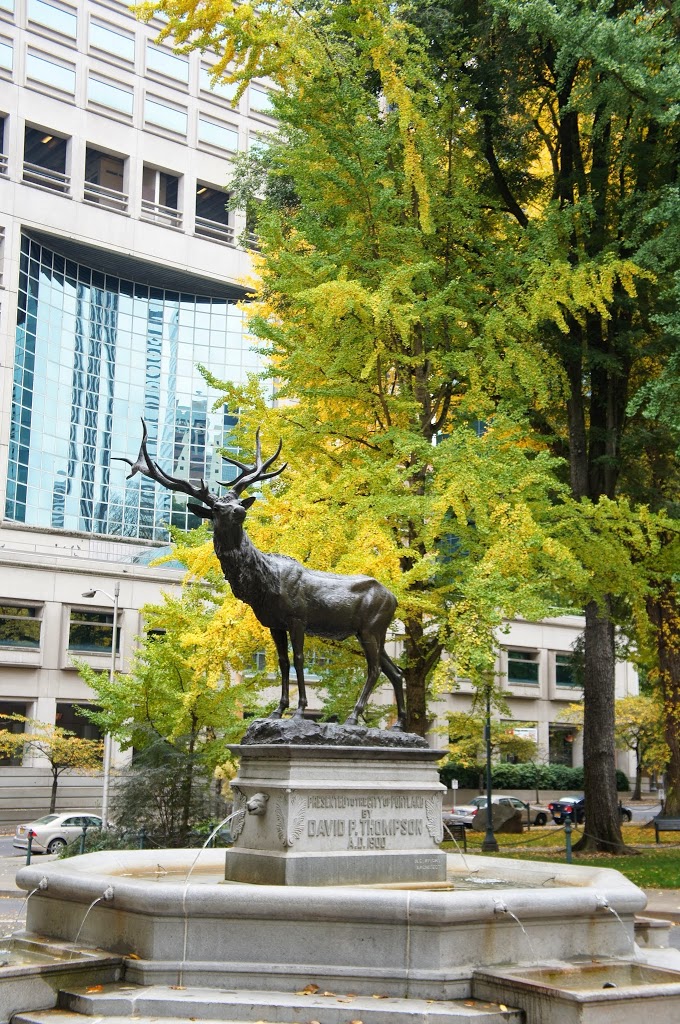
one of the more interesting things in the Plaza Blocks is the statue and fountain that stand smack in the middle of Main Street. it was donated by David P. Thompson, who, among other notable positions, served as Mayor of Portland from 1879-82. he also served in the Oregon State Senate, in the First Oregon Cavalry during the Civil War, and as U.S. Minister to the Ottoman empire (for a year at the end of the 19th century. back in Oregon, he also served as regent of the University of Oregon, president of the Oregon Humane Society and first president of the Portland Public Library.

the Elk was commissioned of Roland Hinton Perry, who completed many notable works around the turn of the twentieth century. born in New York, Perry studied sculpture at several Parisian institutions in the 1890s. upon returning to the United States, his commissions included a series of bas-reliefs for the Library of Congress, a potential design for the statue atop the Pennsylvania Capitol building, a statue of Benjamin Rush in Washington and General George Greene at Gettysburg, and a pair of lions on the Connecticut Avenue Bridge in D.C.

Lownsdale & Chapman Plazas


without any grand plans for our time in Portland, beyond seeing friends and family and a drive down to Bend, we found ourselves out wandering around downtown, enjoying the spectacular fall weather, shuffling our feet through crisp and freshly fallen leaves. one of the first places we walked through was a pair of plazas flanking the Thomson Elk statue, which stands smack in the middle of Southwest Main Street. the plazas are named for Daniel Lownsdale and William Chapman and host towering trees, the likes of which I haven’t seen in a city of substantial size in recent memory.

Lownsdale arrived in Oregon from Kentucky before 1845 and became a member of the provisional legislature in 1846. he established the city’s first tannery on its northwest side and purchased part of what became downtown Portland from one of the city’s founders (Francis Pettygrove) in 1848. he was influential in helping determine the current layout of Portland — with small blocks of 200 feet by 64 feet with contiguous park blocks such as the one that now bears his name.

Lownsdale Plaza plaza is home to a monument to the Spanish-American War and two howitzers found at Fort Sumter donated by author Henry Dosch. Dosch claimed the howitzers had been used by both sides during the Civil War.

the adjoining park is named in honor of William Chapman, another early settler of Portland with a long political career. he settled in Portland in the late 1840s after traveling from Iowa, where he’d served as a Congressional Delegate for the Iowa Territory, by way of the Oregon Trail. he moved around the region, with a successful stint in California during the 1848 gold rush. he served in the first Territorial Legislature and, when the session ended, convinced Thomas Dyer to move from San Francisco to Portland to establish a newspaper. The Oregonian is the oldest continuously publishing newspaper on the west coast, predating the founding of Portland. he purchased land from Lownsdale and built a home on the site of what is now the Multnoma County Courthouse, where he practiced law for many years even as he moved around the state – to raise cattle in Southern Oregon, serve as lieutenant colonel of the militia during the Rogue River War of 1855-56, and serve as surveyor general from 1857-61 (when he resigned due to opposition of Lincoln’s election). in his later years, while continuing to practice law, he fought to get Portland connected to the Union Pacific transcontinental railroad to ensure the city would continue to grow and remain connected to the rest of the coast and country. (his proposed line was never built.) in 1870, he sold the land now occupied by the plazas that bear his and Lownsdale’s names to the city of Portland.

Petřín Hill


after exploring the rest of the Czech Republic by various modes of public transportation, I returned to Prauge eager to visit sites I hadn’t had time to visit at the outset of my trip. high on the list, right the abandoned castle fort of Vyšehrad down the river, was Petřín hill. the hill stand some 327 meters above sea level, climbs 130 meters from the bank of the Vltava River and is covered almost entirely by parks and recreational trails.

the day I visited (in the middle of a week at the beginning of October) was cool and dreary and the park proved mostly quiet. rather than climb up, I opted for the three-stop funicular that runs between the neighborhood of Malá Strana beside the river and the top of the hill.

the funicular began operation in 1891 using water balance propulsion, but closed at the outset of the First World War. it did not resume operation until 1932, when all the equipment was overhauled or replaced. it ran for about thirty years before shifting earth once again forced the closure of the line. twenty years later operation resumed with new cars and following track reconstruction. it runs every ten minutes from March to November.

a lookout tower stands near the upper station of the funicular and offers views over the city from two observation decks. it was built the same year as the funicular after a group visited the Paris World Expo of 1889 and was inspired by the Eiffel Tower. it took four months to complete and advocates are quick to point out that, while inspired by the Parisian example, it differs significantly in design, with an octagonal base and support structure.

Petřín hill has featured in numerous pieces of Czech literature, including a short story by Franz Kafka (“Description of a Struggle”) and in Milan Kundera’s The Unbearable Lightness of Being. my interest in the hill, however, stemmed from a novel proposed for use in the Muir Writing Program — Mark Slouka’s The Visible World. it is one of the best and most melancholy books I’ve ever read — certainly the best book I read in the year preceding my trip to the Czech Republic. the heart of Visible World revolves around the wartime experiences of the narrator’s mother, whom he has deduced had a great love who died during the Second World War. there’s an intense scene set atop the hill involving gestapo and a firing squad.

despite the verdant, serene recreational area Petřín is now, it has a dark past, whether the executions depicted in Slouka’s novel occurred or not. in the middle of the 14th century, Charles IV ordered the construction of a defensive wall along the top of the hill to protect the Castle from attacks from the west or south. employing locals in construction, the hladová zeď (or hunger wall), helped people fend off the effects of a famine that descended upon the city in 1361. while it helped many, it was a time of acute hardship among the greater populace. today about 1,200 meters remain of the original structure, which stands some 6 meters high and 2 meters wide. while Charles IV later cultivated a reputation for doing good for the poor, the construction of the wall was probably more strategic rather than a public works project. today the phrase hladová zeď is meant to refer to what is considered a useless public works project.

Victor Steinbrueck Park

we wrapped up our time on the waterfront with a stop at Victor Steinbrueck Park to have a sit and (for some) to enjoy the beverages procured from the first-ever Starbucks. since the weather was fantastic, the relatively small park was packed with people lounging about on the grass.

the park, located in a wedge of land on top of the bluff next to the Pike Place Market, came under the jurisdiction of the city in 1968 after fire damaged the Washington National Guard Armory that stood on the site. at the time, debate raged about the future of the Pike Place Market and surrounding spaces — developers wanted to tear it down in favor of the aforementioned high-rise with hotel, apartments, hockey arena, etc. proponents of preserving the Market succeeded in saving both the market and partially-destroyed armory over the road. the city transferred oversight to the Parks Department in 1970, which landscaped the area and named it “Market Park” in 1982.

Victor Steinbrueck, a local architect, was instrumental in in the Pike Place preservation but, apparently, the city didn’t feel it appropriate to honor him during his life by naming the park after him. upon his death in 1985, however, they renamed the park on the site of the armory (which he’d championed to preserve as well, though unsuccessfully). the park hosts two cedar totem poles, designed by Steinbrueck.

in addition to the tourists that stop by for views of Elliott Bay on their way to or from the sites along Pike Place, the park attracts an assortment of less-than-savory characters as well. the view is just as good if you’re homeless, addicted to an illicit substance, mentally unstable, or in need of performing an odd, repetitive dance to the tune of a busker’s guitar. there was a guy doing just that right in front of where we sat down — he had long black and gray hair and was wearing a leather vest, performing something reminiscent of what you’d see at a pow wow, repeating the same motions in four directions and moving out of the way of large groups of people trying to get through the park.

the Bean

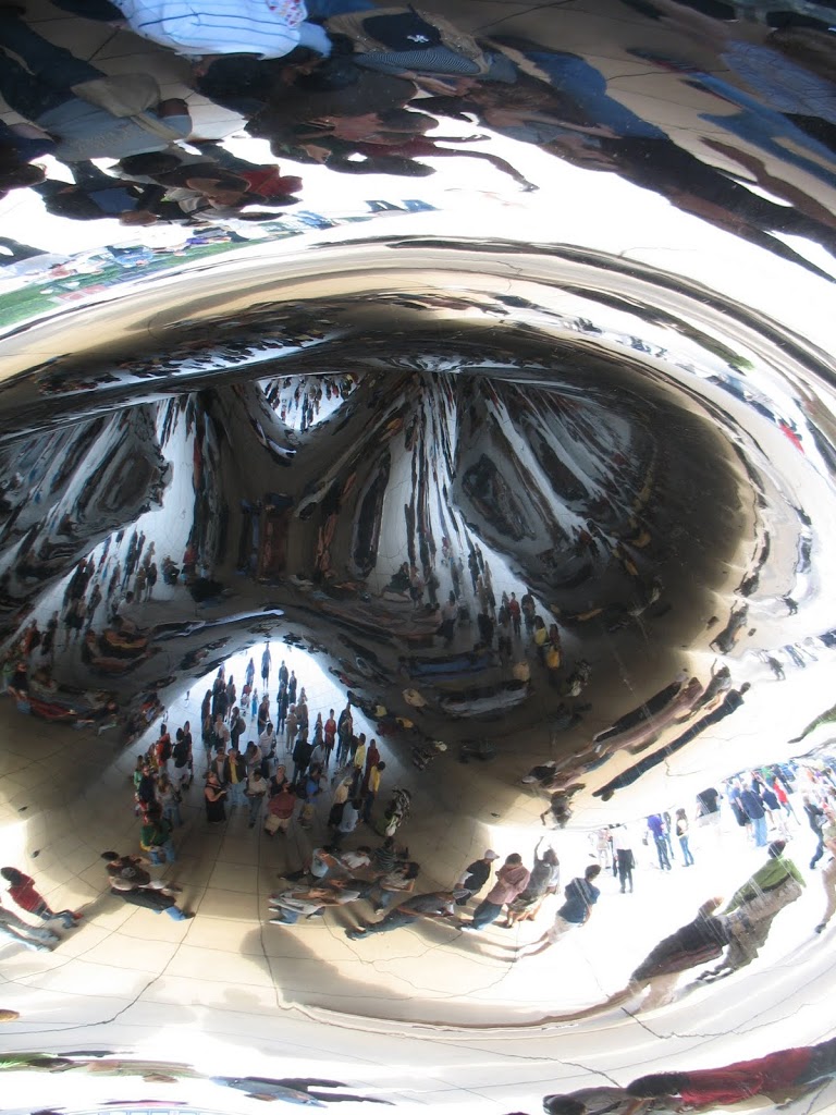
over the weekend, I went to Chicago with my parents to  check out the Green Festival and after checking out the booths and speakers at Navy Pier, we opted to round out the day with a photo op at the “Cloud Gate” in Millennium Park.

the sculpture was inspired by liquid mercury, as it distorts and reflects the city’s skyline as if it were a giant drop of mercury. it’s made up of 168 stainless steel panels welded together. Anish Kapoor’s designed was selected through a competition, though concerns about execution arose almost immediately. in particular, the weight of the sculpture had to be considered in the construction of the Park Grille, atop which the Bean sits. on the underside is an omphalos (indentation), that distorts and multiplies images of the underside of the Bean. the apex of the omphalos is 27 feet off the ground, or 15 feet from the apex of the exterior of the structure. (it’s dimensions are 33 ft x 42 ft x 66 ft.) the incomplete sculpture was unveiled at the opening of Millennium Park in 2004, but it was then re-covered while construction (mostly polishing) was completed. it was formally dedicated two years later, and has since become a major tourist destination and photo op.

we’re the group of three in the middle of the reflection near the back.

wiki

St. Stephen’s Green

once enclosed, St. Stephen’s Green is now the main public park in central Dublin. the wall went up in the mid 17th century, was replaced by the surrounding homeowners with less-imposing railings in 1814, and finally opened to those who did not reside along the perimeter in 1877. (the land was opened to the public in part by the initiative of Sir A.E. Guinness, of the brewing family.)

throughout Ireland, the weather can be quite unpredictable, changing with little warning. the day I spent in Dublin, it vacillated between fantastically sunny, to crummily gloomy, to bursts of rainshower. luckily, the time I spend wandering around St. Stephen’s green was remarkably sunny, and showed off to remarkable effect multiple shades of green. there are paved paths around the perimeter and crossing the park. there’s a bandstand (seen above) and a remarkable number of statues and sculptures. one of Oscar Wilde in repose offers particularly amusing (or tasteless) photo opportunities. there are also busts or statues commemorating leaders of the 1916 Uprising, including one of the Countess Markievicz.

Cliffs of Moher

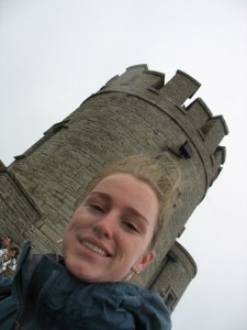
apparently, it’s actually quite the rare day when you get crystal clear skies and a good view of the Cliffs of Moher. weather not withstanding, the Cliffs are pretty amazing. rising 120m (394 ft) from the Atlantic at Hag’s Head on the south end, they reach their highest, 214m (702ft) above the sea, 8km north, just beyond O’Brien’s castle (which was built in 1853). on a clear day, you can see to the Aran Islands and Galway Bay, and even the Ten Bens in Connemara. it’s one of the most visited attractions in Ireland, pulling in as many as a million people a year. I cannot imagine what the place would have been like had I visited during the height of tourist season, with coach buses choking the parking lot and disoriented, jet-lagged tourists wandering all over the place. as it was, the visitor’s center was packed — wall-to-wall people; forget about a leisurely browse through informational material or looking for the perfect gift in the shop. maybe it was the weather: no one wanted to brave the wind and mist, or had just done so and wanted an opportunity to warm up before heading back to the car or coach. try to dry out some before sitting another hour or two. really, not unlike a lot of the other heavily touristed sites that I visited. I wager if we’d gone to the Blarney Castle, it would have been even more choked than the Cliffs of Moher.

the Cliffs were a convenient visit on my drive from Dingle to Galway. the day that I visited started out cloudy, but not misty or rainy. the entire drive up through Cos. Kerry and Clare, in fact, was overcast. after about twenty minutes, though, the cloud that had been hovering over the Cliffs descended and gave me a right soaking. (lucky me, I had a change of clothes handy for when I returned to my car, soaked to the skin.) the wind, not surprisingly, wasn’t on my side either. O’Brien Tower stands about half-way along the Cliffs and it is not exaggerating to say that the building is assaulted by the winds. you know the clip of Conan at the castle? spot on. granted, it wasn’t nearly that bad the day I visited, but the wind wouldn’t have to ratchet up much to get there.

two other things I found interesting during my visit: while the Cliffs are maintained by the Office of Public Works (and thus technically free, despite the fee charged to park in their lot, which is the only one for at least a mile in any direction), the land that runs behind the Cliffs is privately owned. as such, the land is in use … by cows! as I mentioned in a previous post, farm life has pretty extensive reign on land once you get out of the cities. if it’s good grazing land, there are sheep, cows, or even donkeys munching it up. the pastures fenced behind the Cliffs were filled with cows in various shades of brown.

along the wall, as well as along the river in Galway, there were signs for the Samaratin’s helpline. there are people hired to walk the Cliffs of Moher, ostensibly to answer questions and help tourists, but more explicitly to make sure that no one in distress tries to avail themselves of the height of the cliffs. there are walls built up from Liscannor slate (in which you can see marks left by worms, snails and eels from ages past), but with the wind gusts it can still be quite dangerous. and it is not far a far leap from this side of the slate to the edge of the cliffs, if one is desparate and thus disposed. I climbed over an “extreme danger, do not pass” sign and can completely understand how, on a particularly gusty day, one might get swept over the edge and into the sea some 400 feet below. not that it stops many people from exploring beyond the paved boundary of the cliff-side walk.
seeing signs for Samaratin’s so many places also got me wondering why similar signs aren’t posted in more places in the U.S., whether on bridges or river tow-paths or tall buildings. just a little, bright plaque offering assistance to those perhaps in need. maybe we just stick to the big places, like the Golden Gate Bridge, and hope for the best everywhere else. maybe there are actually more options for the clinically depressed. maybe private gun ownership makes it less necessary to have alternative means of ending one’s life.

lastly, the Cliffs of Moher is up for selection as one of the New 7 Wonders of the World. check it out, and vote if you’re so inclined.