many of you have heard my tale of how on one of my wonderful, sunny Saturday afternoons in the Czech Republic I ended up hiking upwards of 28 kilometers. an unexpected 28 kilometers; I set out with guide book in hand, telling me “The most enjoyable way to get here [Štramberk] is on foot through the hills – 8 km on a red-marked trail from Nový Jičín město train station — or across the river from Nový Jičín horní nádraží station” (emphasis added).
my previous hikes proceeded without incident, lasted as long as I anticipated they might, and allowed me to see some lovely countryside and rural Czech life that I would not have seen otherwise. the trail heads were easy to find and easy to follow. and right there — with the trail head — my unexpected adventure began. from the bus station, I headed for the ubiquitous town square, knowing that I could find some direction from there. and so I did, but after spending twenty-some trekking up a steep hill (with exceptional views of Nový Jičín in the valley), I came to a sign that said “Štramberk 14.5km <– that way”. back down the hill I trekked, back through the town square, searching for the the red stripes that would take me in the other direction.
forty-five minutes later, after zig-zagging past the bus station and (what I learned later to be) the město station, crossing over a trickling canal twice, and wandering up and down all manner of residential streets, I gave up … only to see the elusive red-marked trail around the next corner. in spite of what the universe hinted at for me, I shrugged and turned around, in search of picturesque Wallachia…
more back alleys, residential streets with high rises and single family cottages, crossing the canal a couple more times, past the horní nádraží (which certainly didn’t look like it still received passenger trains of any kind …) — thirty more minutes later and I was finally into something resembling “wilderness”, though it was really just farm fields. a sharp turn to the right took me up yet another steep, steep hill, past a fire circle and over trickling streams — now with the red-marked trail always in sight.
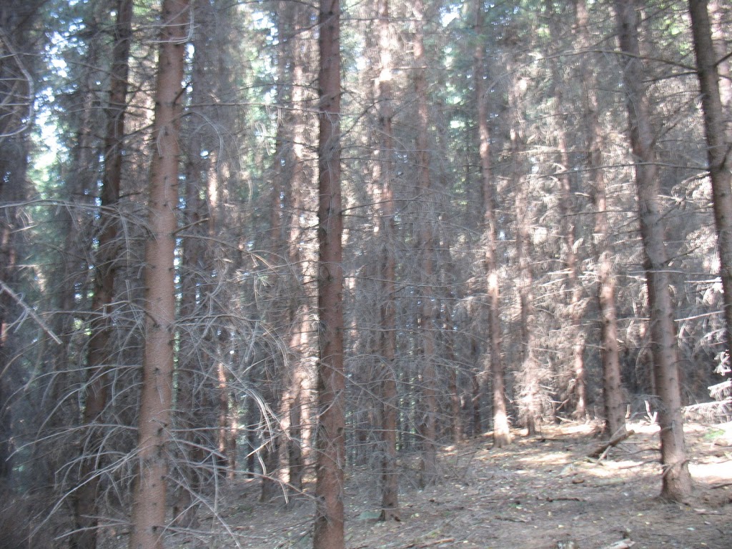
one of the most interesting characteristics of the forest on this particular hike was the closeness of the trees. whereas elsewhere undergrowth had been thinned and deadened lower branches removed, throughout the hike, trees (particularly the evergreens) grew close together and were crowded with black, apparently deadened branches.
as interesting as this undergrowth was, however, after about an hour I was getting rather anxious to find another mileage sign or, really, any indication as to the distance to my destination. the last sign I’d seen — at the top of the hill in the wrong direction — said 14.5 km, but where did that measurement come from?
I eventually emerged from the trees (still no sign of distance markers) and, climbing to the crest of yet another hill, spied what seemed to be my destination in the distance and, really, if I can see it from here, the hike can’t go on for much longer, right?
for reasons still unclear to me, rather than heading straight onwards towards Štramberk, the path continued to the right, through cow pastures and down the back side of the hill. at about this time I began to seriously question the guidebook and my foolhardy, blind reliance on its advice.
 |
| I’ve got HOW much further to go?! |
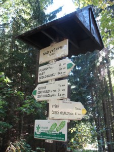
finally (!) I came upon a directional sign and it did nothing to bolster my determinedly-not-yet-dispirited spirits. though upon seeing the distance back to Nový Jičín I felt rather vindicated in all my ill-thoughts about the veracity of my guidebook’s distances: if I’d already come 8.5km from the město station, and the sign clearly indicates at least another kilometer and a half to Štramberk, there is no way on this green earth that the hike is a mere 8km from the central train station. of course (as I learned), that first destination in town is the municipal swimming pool which, really, isn’t anywhere close to the sights. in fact, it’s at least a kilometer back through the valley from the bottom of this hill:
 |
| getting closer to Štramberk… |
the white speck on the left-most hill in the picture above? that is the hill and tower seen here. still so, so far to go. eventually, after giving up on the red-marked trail after it tried to lead me back the way I’d come one, final time tooooooo many, and detouring past the National Gardens of Kotouč and the Šipka cave (more on that in another post) I finally made it to the central square, really to exhausted to enjoy much of the admittedly picturesque town.
I climbed the steps to the castle walls and tower (again, more on that another day) and, after spending a few minutes to enjoy the view and sounds of Czech tourism for Czechs, headed down to catch a bus back to Nový Jičín. (that mowed field in the middle of the hill in the middle of the picture below — I’m pretty sure that’s where I stood to take the view of Štramberk picture above.)
after waiting a half an hour and attempting to get on a bus heading to a town farther east (which would get me no closer to Olomouc), I consulted the timetable posted at the bus stop … and discovered that the bus from Štramberk to Nový Jičín runs on weekdays and Sundays only. or, to put it another way: any day of the week except the day of the week that I wanted it to run. the much-longer-than-expected hike that I’d psyched myself up to complete with the knowledge that I could take the bus back to Nový Jičín just. got. longer.
but damned if I was going to follow that twisty, convoluted red-marked trail back. for the umpteenth time in my life, I rejoiced for my excellent sense of direction and headed down the hill on the same road the bus would have taken. I would not recommend walking down a two-lane rural highway that lacks any kind of shoulder — soft, hard or otherwise, but opting for the more direct route provided by the highway cut the meandering four and a half hour “eastward” trek to the somewhat depressing ninety minutes.
upside to such an abbreviated return trip? no problem catching (what I feared might be the last of the night) bus back to Olomouc. and with time enough to stop at a grocery store for something to eat and the 1.5L bottle of water that I have sitting at my desk at work right now.
downside? are you kidding me that I could have made it to Štramberk and back in less than the amount of time it took for me to get there? as the Blitz would say: “Aw, man!” needless to say, I spent a good deal of time stewing over this while waiting for the bus, wanting nothing more than to sit for about a week and/or rip my guidebook to shreds and burn the remains.
yet, even as I fumed, I knew that one day I would appreciate the adventure the day turned into. Nový Jičín felt very much like a work-a-day town, with people out doing their Saturday shopping, or taking advantage of the helicopter rides offered by the carnival set up on the outskirts of town. Olomouc is of the beaten track for most foreign tourists and, as a consequence, Štramberk was even farther afield; it was filled with Czechs out for their Saturday excursions — couples come to see the cave, cyclists stopping for a beer at the popular pivovar below the castle, families climbing the stairs of the tower and eating whatever roasted local specialties they had cooking at the base. the walk back took me through through the tiny town of Rybi, where got a close look at all the trappings of small village life, including the local pub and school. coming back into Nový Jičín, I walked down a road filled with compact second/summer homes with spectacular gardens (complete with gnomes) and sheds out back and sweeping back lawns with furniture of varying degrees of apparent comfort, a community vegetable garden, and a whole lot more sights that felt so splendidly Czech.
yeah, I would have preferred to start the day heading in the correct direction, that the trail not take the perplexing meanderings that it took, that the bus be running on a Saturday, that I’d had a detailed topographical hiking map … but in the end I don’t regret the adventure. my feet hurt like hell and I could have spent the night whining about how terrible the day turned out but when will I ever be in Nový Jičín or Štramberk or Olomouc again? got to take advantage and rejoice in the opportunities that life presents you. that is something that the Czech Republic helped me learn: travel is about the unexpected experiences — the adventure. without the unexpected, we just have the same snapshots of the same sites that everyone else has, with nothing to mark our experiences or ourselves as unique.
 Štramberk is situated in a notch in the foothills of the Beskydy mountains in the Moravian-Silesian Region. the two most famous sights are the castle, perched atop Bílá Hora, and Šipka Cave. the castle tower can be readily seen from the surrounding mountains — as I learned throughout my hike. the northern path from the town square takes you under an arch with the inscription ‘Cuius regio – eius religio – 1111’ (‘Whose realm, his religion’). I can’t find any conclusive explanation (at least in English) as to whether the Romans visited or occupied the site that early, but it seems possible. the town was formally established in 1359, though the first recorded settlement dates from 1211.
  the castle itself was constructed sometime in the 12th or 13th century, either by the Benešovic family or by Přemyslide princes (one of the oldest and most revered dynasties in Czech royal history). at some point, it fell into the keeping of the Knights Templar, but upon the abolition of the order reverted to the hands of the king and spent considerable time passing between owners. eventually, the Benešovic took possession, but by the mid-16th century the castle began to deteriorate. the city, who now owns the site, spruced up the structure that remains, including the recognizable cylindrical tower known as the Trúba. the tower is 40 m tall and 10 m in diameter and was covered at the turn of the 19th century and turned into a lookout tower under the guidance of a famous Prague architect.


