one upside to visiting National Parks like the one in the Badlands a second time as an adult is that my memories have faded enough to allow for a wholly new experience. I have vague recollections of our last trip to the monuments and parks of western South Dakota, but nothing concrete. I remember washing dishes at our campsite, being surrounded by bison on a drive through Custer State Park, going to a cave (but nothing about the cave), lights on the surface of Rushmore (but not the carving itself, really), the heat and dryness of the Badlands.
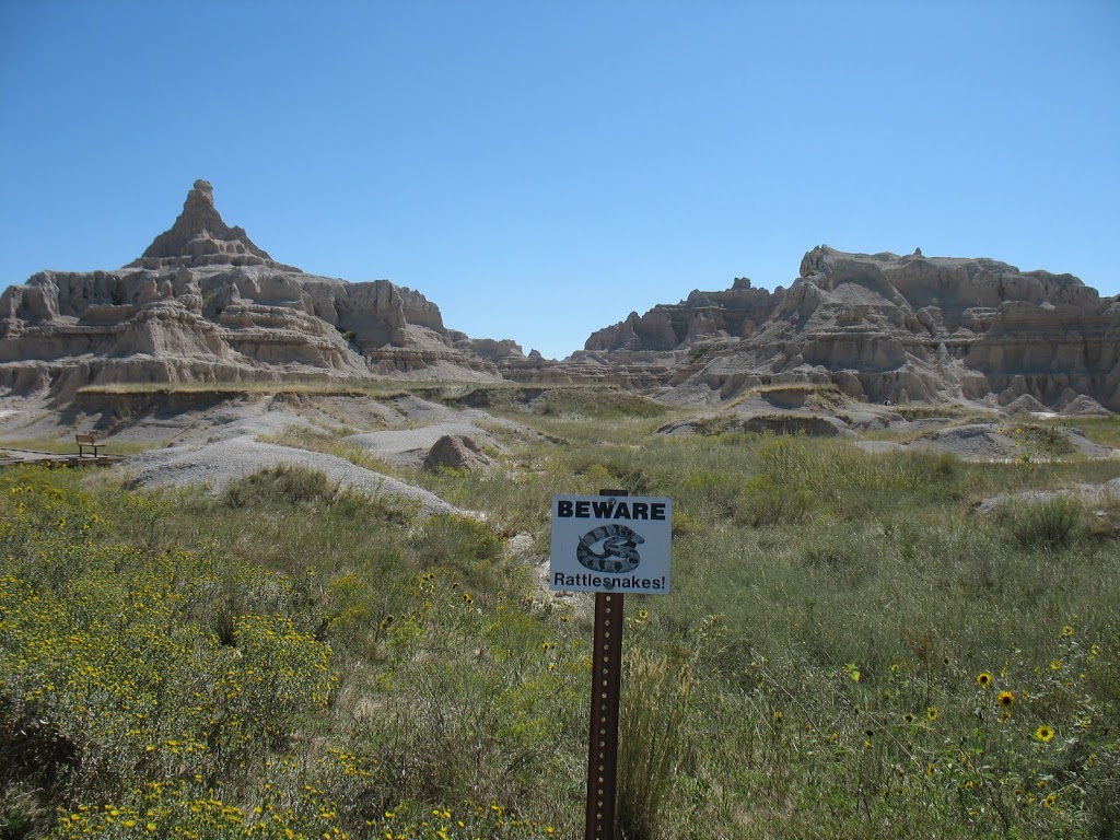
now that I’m older, however, and have a much more comprehensive understanding of the geological (or other) forces involved in the creation of these sties, I am much more in awe. the height of the buttes and spires is obscured as you approach from the north as they’re carved out of the plains moving southward. they’re impressive and, as the name suggests, impressively inhospitable-looking. true, a fair amount of prairie grass covers the top of the butte and on the plains below — enough that someone was conducting a controlled burn of the lower prairielands as we drove through the Park.

people have inhabited the area for more than 11,000 years, the earliest of which were mammoth hunters. the Lakota moved in during the 18th century and came to dominate the region in part because of the command of horses they learned from Spaniards (it’s much easier to hunt bison on horseback …). French trappers quickly encroached on the Lakota, and they were shortly followed by soldiers (see: Custer), miners (see: Deadwood), cattle farmers and homesteaders (see: Dust Bowl).

following Wounded Knee, the Lakota were confined primarily to reservations, including the Pine Ridge Reservation which shares oversight of the Stronghold Unit of Badlands National Park. during the Second World War, the U.S. Government took possession of more than 300,000 acres of the Reservation to use the land as a gunnery range. accuracy wasn’t always great and several buildings in the town of Interior (just south of the North Unit of the park) were damaged. nearby farmers often had to take cover to save themselves from falling or misdirected ordinance. among the many informational PDFs available on the Park website is one on the history of the gunnery range that includes information on identifying and avoiding unexploded ordinance (UXO).

people have inhabited the area for more than 11,000 years, the earliest of which were mammoth hunters. the Lakota moved in during the 18th century and came to dominate the region in part because of the command of horses they learned from Spaniards (it’s much easier to hunt bison on horseback …). French trappers quickly encroached on the Lakota, and they were shortly followed by soldiers (see: Custer), miners (see: Deadwood), cattle farmers and homesteaders (see: Dust Bowl).

following Wounded Knee, the Lakota were confined primarily to reservations, including the Pine Ridge Reservation which shares oversight of the Stronghold Unit of Badlands National Park. during the Second World War, the U.S. Government took possession of more than 300,000 acres of the Reservation to use the land as a gunnery range. accuracy wasn’t always great and several buildings in the town of Interior (just south of the North Unit of the park) were damaged. nearby farmers often had to take cover to save themselves from falling or misdirected ordinance. among the many informational PDFs available on the Park website is one on the history of the gunnery range that includes information on identifying and avoiding unexploded ordinance (UXO).
the site was authorized to become a National Monument in 1929 but didn’t become one until a decade later. it was redisignated a National Park in 1978 and in 1999 took over supervision of the nearby Minuteman Missile National Historical Site.


