California’s Highway 1

SONY DSC

one thing I’ve wanted to do since I first lived in California was to drive along Highway 1. the few times I drove up to the Bay area while living in San Diego, though, I had time constraints and no one to enjoy the drive with me. in hindsight, I’m glad I waited because we had a great time driving back from Monterey along Highway 1 as part of our mini-moon. neither the drive nor the weather disappointed as we set off early on a late-August morning.

the highway, which runs along the coast from Orange to Mendecino County was constructed in segments starting in 1910 and sported many names over the last century, until a legislative act designated it all California State Route 1. between 1915 and 1964, all the different segments had numerical designations, but only highway planners and legislators ever referred to those numbers; designations never appeared along the roads themselves.

the stretch between Carmel (just south of Monterey) and San Simeon (site of newspaper magnate William Randoph Hearst’s famous castle) received initial state funding in 1919, followed by some federal funding in 1921 and support from the New Deal later. much of the highway went up because of the labor of convicts. the San Quentin State Prison set up three camps along the route, paid inmates $0.35 a day and offered reductions in sentences in exchange for their unskilled labor.

View of Coastal Hwy 1

the stretch of highway we drove required the construction of 33 concrete bridges, including the iconic Bixby Creek Bridge near Big Sur. prior to the completion of the bridge, residents of Big Sur often endured months of isolation in winter; the single-lane stagecoach Old Coast Road, which connected the community to the inland, became impassable with rain and the rugged coastline made deliveries from Monterey or San Francsico by boat difficult. the bridge (and creek) are named after a gent who moved to the Monterey Peninsula in 1868 and purchased a large tract of land near Big Sur to harvest lumber and produce and distribute other wood products from his sawmill. the bridge was designed by F.W. Panhorst who, along with highway engineer C.H. Purcell, opted for a cement span for its lower material and maintenance costs (a steel span! that close to the ocean! what kind of fool would do that?!) and for its more natural aesthetic. it took 14 months to construct and, upon completion, was the longest concrete arch span bridge in the California highway system. the bridge itself is 714 feet long, the main arch is 320 feet long, and over 280 feet high. extensive seismic retrofitting occurred in the late 1990s but even after the updates, the bridge remains classified as “functionally obsolete” because it is less than 32 feet wide, as required with newly-built bridges.

the route finally got consistent numbering in 1964 thanks to legislative action, though different segments of highway have different names (Pacific Coast, Cabrillo, and Shoreline) going up the coast and local roads often weren’t changed to align with the numbering. the entirety of route 1 is a Blue Star Memorial Highway, honoring armed forces and the section between Big Sur and Carmel is a national scenic byway, declared in 1965 and dedicated in 1966 by Lady Bird Johnson from the Bixby Creek Bridge. and all around well worth the drive time!
cow mailboxes

have a glass of fresh milk!

today’s post strays from our usual theme of travel and general history in favor of something from my personal history.

it’s a drive that I’ve made many, many times in the last nine years, and one that I mostly hated half the time while I was at school and it stood between me and getting home or me and getting back to Galesburg. I can tell you precisely how long it will take to get from my front door to campus — with variations for a pit stop in either Savanna (where I turn south onto the River Road) or in Freeport (where I often stopped for a snack at Culver’s), how many counties the route goes through (9), not how many times I’ve been stopped at the train tracks that cross the highway in Fulton (because it’s been that many), where houses were foreclosed on long before it was the norm, where buildings have burnt down and been rebuilt … if you’d told me a dozen years ago that I’d make this drive dozens of times, I’d have scoffed. mostly because I’d never heard of any of the towns I drive through south of the border, let alone Knox and Galesburg. now that I only make that drive once a year, at most I’ve come to really enjoy it; it’s novel once again, rather than tedious from making it so frequently, and while I no longer get to watch the changes wrought by the seasons, I do get to watch the changes wrought by the years.

my absolute favorite thing about driving to and from Galesburg is passing the cow mailbox at a farm just south of Freeport, Illinois. over the years, I’ve passed three different versions, the most recent of which went up in the last year. unfortunately, I never got a shot of the first one, but haven’t made that mistake with subsequent ones. I always thought of the first one (above left) as Lucy. this new one seems more like a Buddy. we’ll see if the name still suits him the next time I drive past, or if he’s been replaced by someone new in a few year’s time.

Posted by Picasa

Wall, South Dakota

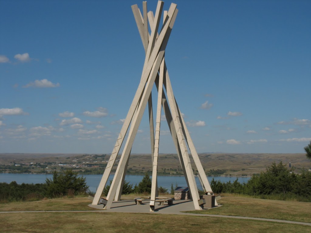
the rest stop on I-90

anyone who’s driven towards, through, or around South Dakota has seen signs for Wall Drug in Wall, South Dakota. I’ve seen billboards for it in Minnesota and Iowa, not to mention all across the length of South Dakota.  we started joking about whether or not to visit the famous Drug Store somewhere between Sioux Falls and the Missouri River, in spite of the fact that none of us had any interest in diverting off the road for the quintessential interstate tourist trap. I’d say “give ’em a giant ball of twine and they’ve got kitchiest road side attraction west of the Missouri sewn up” except I don’t think they need a giant ball of twine, really.

perhaps I’m not being fair to Wall Drug. I know we stopped there on my earlier westward trek to the Black Hills, but on pain of death and dismemberment I couldn’t produce any concrete memories of the place. all I know is that Wall Drug started up during the Depression (in 1931) by a Nebraska pharmacist who struggled to make his business work. his wife got the idea to offer and advertise free ice water for visitors of the newly-opened Mount Rushmore and, 80 years later, they boast handing out something near 20,000 cups of water a day during peak tourist season.

anyway, despite swearing we wouldn’t set foot in Wall, we did have to grace the city limits to get back onto the Interstate after diverting through the Badlands. and, leaving the Black Hills around 3 p.m., it turned out to be a decent place to stop and get some dinner. the local restaurant we found even had passable veggie options! (mostly because they had an extensive appetizer menu of fried foods.) in a town of 766, it might have been the only game besides the Subway and when a party of nearly two dozen people started showing up (a caravan of indeterminate make-up and origin) it stretched capacity to the limit. thankfully, we got in and out just in time and got out of Wall, bellies full and not a single Drug Store seen.

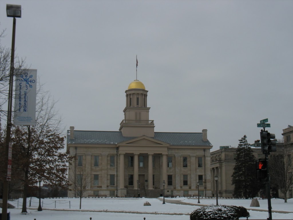
Iowa City’s Old Capitol Building

Iowa had several different territorial capitals before Des Moines became the permanent site of state governance. this cornerstone for this particular building, the third and final territorial capitol, was laid in 1840. construction did not start off smoothly, however, as the architect resigned a mere nine days into the project, leaving one of the territorial commissioners to oversee the project. the limestone blocks and oak beams used in construction came from around Iowa and the copper covered the original dome. it took two years to complete four rooms in the capitol, two of which housed the legislature.

the territorial legislature met in this building for six years, until Iowa became the 29th state to join the Union (in 1846). Iowa City remained the state capitol for a decade, after which point legislators decided to move the capital to Des Moines due to its location at the center of the state. the building wasn’t completed until after the removal to Des Moines, which occurred shortly after the appropriation of $4,000 to complete the capitol. among other events, the Old Capitol Building saw the drafting of the Iowa state constitution and the inauguration of the first governor (Ansel Briggs), as well as the authorization of the state’s first public university (now the University of Iowa). in January 1857, the State Historical Society of Iowa was founded in the capitol.

when the capital moved to Des Moines in 1857, the Old Capitol became the first permanent structure owned by the University of Iowa (to that point they’d held classes in rented space). until 1863, the entire university fit into the building, though during the 1858-59 academic year financial and organizational problems kept most of the university closed. (the Normal School — now Department of Education — continue to meet and remained in the Capitol building until 1960.) over the next five decades additional appropriation of funds allowed for the construction of four additional buildings, now known collectively as the Pentacrest, which make up the heart of the UI campus.

renovations occurred throughout the 20th century. the first major project came in the early 1920s, when (among other things) a 650-pound crystal and brass chandelier was added to the Senate chamber and the dome was gilded gold leaf. between 1970 and 1976, historical restoration occurred, returning the building closer to its initial Greek Revivalist design. this project also set out to create a “living museum” that included historic furnishings and displays (not unlike the Wisconsin Historical Society building, I imagine). the Capitol reopened on the nation’s bicentennial and was listed on the National Register of Historic Places.

in 2001, while removing asbestos from under the dome in another renovation project, contractor using open flame torches and heat guns on the gold dome set it on fire. thank to a concrete slab that was installed beneath the dome during the 1920s restoration, damage was contained to the dome, which was completely destroyed. it has since been replaced by a wood dome covered in gold leaf, complete with new bell (the old, mangled bell is now on display inside). as of 2006, the building is once again open to the public.

visit here for a virtual tour, or here for more extensive history of rectifying the fire damage.
more info from wikipedia.

historic Julian

another reason I so enjoyed driving up to Julian is the sense of history the town possesses. even though California became a state immediately after Wisconsin (and was followed by Minnesota), and San Diego was incorporated the year the state was established, it always seemed to have a more limited sense of history. (I anticipate that at some point I’ll get into San Diego history, but today is for Julian.)

the unincorporated town is a California Historical Landmark, and the surrounding area is the Julian Historical district. it was established following the Civil War by soldiers who headed west to California. gold was discovered in the area by a former slave in 1869 and a minor gold rush began. the lode didn’t yield much, but during the period another settler brought some apple trees up into the mountains and discovered that the plants flourished. now Julian is well known for it’s apple pie. mmm, apple pie.

the town was home to some of the first settlers in San Diego County and, according to information from the 1880 census, the majority of blacks in the county lived in and around Julian. the first business to be owned and operated by blacks in the county was in Julian — the Robinson Hotel, owned by Albert and Margaret Tull Robinson. it’s now the Julian Gold Rush Hotel (pictured above). it’s on the National Register of Historic Places.

the sky goes on for days

yesterday I had a sudden and strong desire to be driving through the mountains on the way to/from Julian. whenever I needed to get away from San Diego for a while, I’d take to the hills. drive a loop that would take me up through Poway, and the fire-scorched land around Ramona, Santa Ysable and Wynola. sometimes I’d double back through Ramona, but more often I’d take the twisty turny mountainy road down through Cuyamaca Rancho State Park. the land to the east and south of Julian is devoted to parklands — Cuyamaca, Cleveland National Forest, and Anza-Borrego Desert State Park/Wilderness. on days like the one when I took this picture, the sky is an amazing gradient of blues, from the whispy white-blue near the horizon to an incredible azure above your head. it’s also a drive that requires your attention — switchbacks, narrow roads, blind curves. one of my favorite places on that drive is a short stretch through real (Californian) forest (with actual trees and low scrub brush, much more reminiscent of forests I am used to), where there are two curves that turn back on themselves and you drop your speed down to near nothing. take them a little on the speedy side and it’s a thrill.


Cuyamaca State Park association

vehicular travel

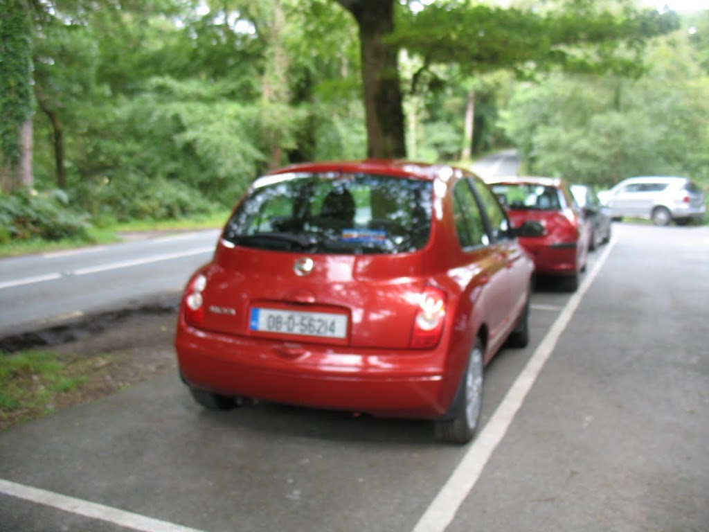
driving a manual transmission on the other side of the road was a great adventure in itself. apart from the motorways and major arterial roads designed to handle lots and lots of coach traffic, everything is two lanes. and by two lanes, i mean wide enough to accommodate two cars smaller than the one that i drive now (which is considered compact), and nothing else. no hard shoulder, hedgerows everywhere so if you’re not in open fields, like in parts of Co. Kerry or Co. Clare, then you’ve no idea what is coming around the bend. makes for exciting driving, that’s for sure.

when i didn’t have a car, i availed myself of the public transportation systems, local, regional, and international. for the most part, that meant Bus Eireann, the national bus service that connects pretty much everything in the Republic of Ireland. during the tourist season they run a bus from Drogheda to Bru na Boinne — very handy. round trip to central Dublin took about 40 minutes, and out to the beach at Bettystown in about 20. bus stations varied in size and amenaties — Busaras in Dublin, and Europa in Belfast are large and bustling, no surprise. and play host to all kinds of people. the one in Drogheda is mostly just a building to in which to shelter in colder weather. when i went through on my way from Belfast to Cork, our bus was heavliy subscribed (it was a Sunday), so they split us in to two groups: one heading to Cork city and one heading to points in between. it was there that i managed to capture a photo of a hairstyle that seemed to be quite the rage, in Belfast at least. not quite mohawk, not quite … i don’t even know, but certainly special!