Galicia

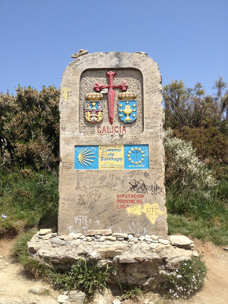
entering the last autonomous region of the Camino!

having never studied much Spanish history while at school (much less monarchical history), the intensity to which people associate with their ancestral kingdom surprised me. natives of Navarra descend from a very different narrative than natives from Castilla or natives of León or natives of Galicia. unlike the more central (and easily-conquerable) regions of Spain, Galicia has an independent streak not unlike that of Catalonia or the Basque country. (a fact mentioned in an article I read today in the Economist about the recent vote in Catalonia in support of independence from Spain.)

the area has been inhabited since the Copper Age by a culture characterized by a “surprising capacity for construction and architecture” and a cult of the dead. migration from the Castillian plain into Galicia during the Bronze age boosted mining interests and swelled the population. their successors, Gallaeci, were of Celtic extraction, lived in fortified villages, and form the basis for the region’s modern inhabitants. founded by the Suebic king Hermeric in 409 C.E., the kingdom of Galicia adopted Catholicism and minted its own currency as early as 449. in 585 the Visigoths annexed the kingdom and reigned (though didn’t much control) for just over a century before Galicia regained its liberty and amicably joined with the adjacent kingdoms for a period.

traditional Galician stew and hearty bread

though it became an independent kingdom briefly in the 10th century as a result of succession fights in Castilla, those same fights destabilized the region and Galicia subsequently fell under the control of a series of external monarchs. beginning in the 14th century, the distant kings began devolving more powers on local authorities (knights, counts bishops, etc.) and increasing after Galicians backed Joanna La Beltraneja in her successful bid against Isabela I of Castilla. towards the end of the 15th century, however, the language began a slow decline that led to the Séculos Escuros (Dark Centuries) when the written Galician language nearly disappeared. another fact some of you might find interesting — in the 1380s, John of Gaunt claimed the crown of Castilla on behalf of his wife, sailed to Spain to battle the French as part of the Hundred Years War, and dragged Galicia into his succession fight.

amazing dessert of local crumbly cheese
drenched in honey and the famous
Santiago almond tart

not surprisingly, Galicia found itself in the cross-hairs of various belligerent parties of the 19th century. the people allied themselves with the British in the Peninsular War and suffered consequences as a result when the French took control of the region for six months (you can “read more” about how they evicted the French from Santiago de Compostela in Bernard Cornwell’s Sharpe’s Rifles, which I was encouraged to read before setting out on the Camino.) the kingdom was dissolved permanently with the unification of Spain under one crown in 1833; a century later, in conjunction with the establishment of the Second Republic of Spain, Galicians voted in favor of a path to autonomy within a federalized Spanish state though the Spanish Civil war preempted implementation. because the initial military coup proved successful in Galicia, the region was spared the worst of the fighting that occurred during the war, though they certainly didn’t go unpunished or un-repressed. (fact I did not know: Franco was from Ferrol, northeast of Santiago but in the same province of A Coruña)

while Galicia has been profoundly affected by the economic and housing crises affecting the rest of Spain in the last decade, the region still retains its distinct, unique character. but more about that later.
O Cebreiro

our arrival in O Cebreiro presaged much for the duration of our Camino and gave us an early glimpse of how distinct Galician culture would prove. the town sits astride a pass some 1,239 meters up that divides León and Galicia; it was immediately evident, looking down the western slope, to see how much differently the weather would be as we crossed through Galicia and finally entered Santiago. while the sun shone brightly as we entered town a thunderstorm swept through during our typical mid-afternoon nap, leaving the air significantly cooler and the cobblestones slick as we made our way from the room in our casa rural back to the pub from whence we’d retrieved our key.

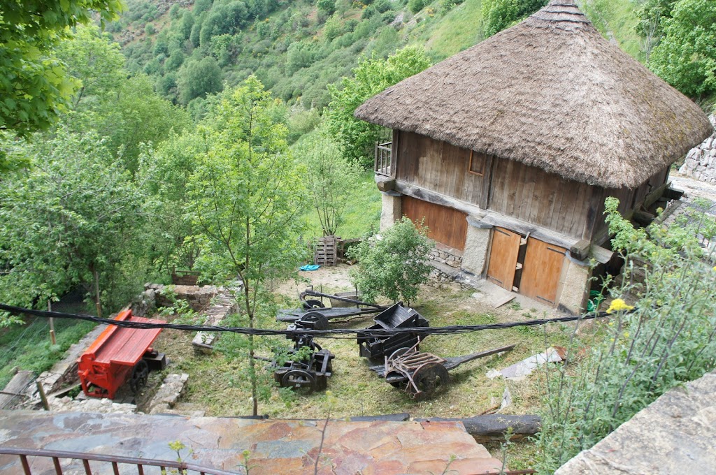
a Roman way station guarded the pass into Galicia during their rule over Spain, but evidence points to even earlier habitation and settlement. the village is known for a large selection of well-preserved palloza structures — circular buildings with conical, thatched roofs that share similarities to the round houses of Iron Age Britain, as well as with those found virtually wherever archaeologists have uncovered Celtic settlements (e.g. Ireland, Brittany, Scotland, Morocco and, at least in fiction, the Gaul of Asterix fame). Galician culture shares much with Celtic traditions of Ireland as is evident throughout O’Cebreiro, and anyone who’s visited both can attest to the similarities in climate. some of the earliest people to inhabit Galicia were of Celtic descent and known as Gallaeci and had according to Roman records, had a particularly warlike spirit that repulsed the more pervasive efforts of the Romans to assimilate them into Roman culture.

in recent years O’Cebreiro has become something of a tourist destination; in addition to the well-preserved pallozas, there’s a museum dedicated to the ethnographic heritage of the region with traditional tools on display. the village is also known for a miracle involving the Holy Grail that reputedly took place in the local church. as my cultural guidebook puts it, in the 14th century the “Grail”, an incredulous priest, and a snowstorm resulted in a miracle; basically, when a local peasant arrived in the midst of a snowstorm to hear mass and the priest berated him for his foolhardiness, the wine and bread he was holding turned into actual flesh and blood. in 1487, Pope Innocent VIII certified the veracity of the miracle and this, in addition to an 1486 visit visit by the Catholic monarchs as they made their way to Santiago de Compostela, did wonders for the prosperity of the village. (the royals donated two “large gold nuggets” and asked the Pope to transfer a degree of authority and autonomy church officials closer to the village and, presumably, more aware of the needs of the inhabitants and peregrinos.)

success of the village in the modern era, as well as many notable improvements to the Camino for peregrinos who traverse it today, stems largely from the work of one parish priest, Elías Valiña Sampedro. he wrote two books on the Camino (and introduced the concept of placing explanatory text on one page with a map facing) and is credited for implementing the ubiquitous (and ever reassuring) yellow arrows to mark the path. he also played a role in collecting and preserving artifacts of rural Galician culture as can now be seen in the museum. he’s memorialized with a bust in the square beside the church; we stopped for a look when we realized we couldn’t go look around the church as interrupting mass wouldn’t go over well.

the second big hill

what I most remember about the day from Villafranca del Bierzo to O’Cebreiro was it being hot and sweaty. to be sure, we had our share of hot, sweaty, sunny, cloudless, thirsty, (sometimes) miserable days over the course of the Camino and more than a few of those words could apply to the day on which we ascended to O’Cebreiro and crossed into Galicia.

despite our departure before dawn (and well before the hotel began offering breakfast), we didn’t arrive at our destination until well into the afternoon. from the outset, the hike climbed gradually up the foothills and into the Cordillera Cantábrica that divides León from Galicia. it was an interesting walk, following what used to be the primary highway into Galicia as we left Villafranca. at some point, in an attempt to better protect the flow of peregrinos braving the oncoming traffic, the government erected a cement barrier to enclose the left-hand shoulder as a dedicated pedestrian lane. with all the hairpin twists and turns in the road, I was thankful for the barrier on more than one occasion, even though the flow of traffic wasn’t that heavy. the snaking two-lane road had been replaced by a six-lane autopista that cuts through a mountain below Villafranca and then continues on, towering over the valley floor, on viaducts and leaving the peregrinos slightly safer as they hike along the road. there were instances, however, when two highways intersected and the Camino took us across the highway through traffic and into tiny villages nestled on the other side of the road. sometimes there was a purpose to this crossing of the road (a cafe or fountain or albergue), but just as often we made our way through the town only to discover we had to re-cross the highway at the other side. as our guidebook pompously observed, the autopista dramatically altered village live for all the towns now bypassed by the “improved” means of transportation. for the most part, the Camino kept most of the villages alive though one has to wonder how the vagaries of tourism (and the status of the Spanish economy) might affect them in years to come. in one town several homes had remodeled basements or built additions to offer cafes or shops to cater to peregrinos; we stopped and had ice cream bars at one that had a stream running behind it. if only I knew then how much farther uphill we had yet to go!
generally, the diversion of road traffic afforded a more pleasant hiking experience. the villages felt older, more rural, more similar to all the small farming towns I’ve known living in south central Wisconsin. I enjoyed seeing a lot more cows grazing along this stretch, too, after weeks of hiking through primarily cultivated fields rather than grazing fields. these butterscotch-colored ones were my favorite.

the last, long, uphill stretch prompted a rather unnecessarily self-imposed challenge; just as we began the final ascent, we encountered a group of young people who had much fresher legs than us, were carrying less weight, and generally had less a sense of what ascending this mountain might mean. turns out they were students from the University of Minnesota traveling the Camino as part of a mini-term course they’d taken. (I found the blog chronicling their trip here: Hiking through History.) as I now know from reading their post about that day, their day started in Astorga — four days of hiking away for us — and only included 8 kilometers of hiking (albeit straight up the hill). it might come as no surprise that this group of twentysomethings just starting their day’s hiking had a bit more energy than us and took the uphill pace a bit faster than we did. or we should have, I should say. normally I’d been quite good about staying hydrated, usually drinking all of my water pack and then some in the course of a day, but as I adapted my pace to the collegians I burned through my water (and energy) faster than normal. we stopped to rest at a bar three or four kilometers from the peak (in La Lagua, if I recall correctly), just before a gaggle of the collegians arrived, for some much needed Aquarius to rehydrate. I felt badly for the proprietor of the bar/alberuge who had to deal with fifteen or twenty American students, most of whom didn’t buy anything but many of whom wanted to fill up water bottles and sit for a bit. I needed the second bottle of Aquarius we bought, thirsty and weary as I was, but even if I hadn’t I might have purchased a second one anyway to make up for any time I ever proved less-than-gracious to a proprietor during the travels of my younger years. that break proved useful in more ways than one; I got rehydrated, realized I’d been trying to keep pace with these collegians when I didn’t have the energy for it, and let some distance fall between us and them so I wouldn’t be tempted to keep up as we finished our climb.

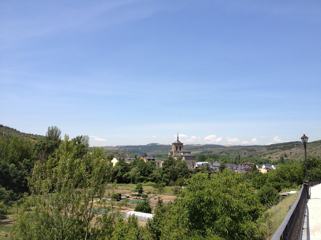
despite the challenges, though, the sunny, spectacular view back towards León from whence we’d come proved worth the challenges and the view forward over Galicia promised new and different challenges. and a bit more rain.

Villafranca del Bierzo

thinking back, it’s kind of impressive how much stuff got crammed into day 26 on our Camino — the Castillo de los Templarios in Ponferrada, TAL episode #465, tasting at Cuatro Pasos, taking a potentially risky shortcut to shave off a couple of kilometers at the end of the day, Brent Spiner on the Nerdist, and the second-craziest shower I experienced while in Spain. I suppose it should come as no surprise then just how relieved we were to stumble into our boutique hotel in Villafranca del Bierzo, Hotel Las Doñas del Portazgo. (if you ever find yourself in Villafranca del Bierzo, I recommend it).

the earliest settlements around Villafranca date from the neolithic age and there’s evidence to suggest it served as an important hub for communication during the Roman period, sitting as it does at the confluence of two rivers (the Burbia and Valcarce) at the western edge of the Bierzo basin and at the foot of the narrow pass that ascends to O Cebriero and Galicia beyond. in the 11th century, the sister of Alfonso VI granted a church to Cluny for establishing a monastery that began cultivating wine. this, along with the explosion of peregrinos during the 12th century, gave rise to a sizable foreign population including many French who aided developing wines. by the middle of the century more than half the town’s inhabitants were foreign.

the city flourished for several centuries because of the Camino and in 1486 the Catholic Monarchs established the Marquesado in the town; the second man to hold the title, Pedro Álvarez de Toledo, built a castle though the one that overlooks the valley and town dates from the 1490s and was recently restored to clean up the damage done when the French burned it in 1812. following the second Marques’ death, the city endured its first of many significant hardships that concluded with the burning of the castle by the French. the plague decimated the town’s population in 1589; a flood washed out much along the river in 1715; during the Peninsular War the town served as headquarters for the Galician army and was sacked three times by the English until finally, after the municipal archives were burned, churches robbed, and castle wrecked in 1810 Spain regained control of the area. sort of — the French briefly occupied the town following the expulsion of the English. twelve years later el Bierzo was declared an independent province with Villafranca as its capitol; that lasted two years.

much of the late medieval and Renaissance character remains in Villafranca (as much of the modern industrial revolution passed the city over) including several well-preserved churches. subsequent to its construction in 1186, the Iglesia de Santiago offered ailing peregrinos an alternative to crossing the remaining 187 kilometers of the Camino; if you were too ill or too injured to continue on to Santiago you could pass through the northern entrance — the Puerta del Perdon — and receive a pardon for your sins as you would at the cathedral in Santiago if only you were physically capable of continuing onward. along the narrow streets are facades you might imagine lining prosperous towns of the middle ages — sturdy construction with impressive stonework — though care for these buildings varies widely.

our hotel stood at the end of one such street; it used to serve as the gatehouse for the bridge over the rio Burbia and has been attentively restored and updated; while the entire place exudes comfort, during the update process they left elements of the original building exposed to give a sense of what the place might have felt and looked like a century ago. while the hotel at the end of the road was lovingly restored, there were many other buildings along the way that hadn’t received the same attention. from the refurbished window balcony of one updated home you could look directly into the dilapidated and burned-out husk of another once-magnificent home that hadn’t received the same attentions. Villafranca del Bierzo was clearly thriving, but it didn’t take much to see signs of the common challenges afflicting the rest of Spain.

tasting wine in el Bierzo

after weeks of consuming the house wines offered by albergues, drinking out of a fountain on the side of a winery, and tramping through acres and acres of vineyard all across northern Spain, we got around to tasting at a bodega (wine cave, basically) on day 26. up until this point, we hadn’t much opportunity to do anything resembling a tasting like those so common around the U.S. I wouldn’t be surprised if wineries in the more traditionally tourist-friendly areas did those types of tastings but when you’re going everywhere on your own bipedal power there’s no real “short side trip” to do anything, much less taste wine.

while Rioja is perhaps better known as a wine-producing region in Spain (at least by me prior to this trip), el Bierzo also has exceptional vine-growing soil and its own thriving wine industry. prior to the arrival of Romans, the region was populated by the Hispano-Celtic Astures people who shared origins with the people of Galicia. while agriculture and an assortment of vines came to el Bierzo with the Roman Empire, it wasn’t until the Middle Ages and expansion of monasteries (primarily those of the Cistercians) that wine production took off. the industry was nearly obliterated in at the end of the 19th century as a result of a phylloxera plague that destroyed nearly all the vineyards in the region (as well as most of those in Europe, actually, thanks to over-eager British botanists who inadvertently brought the aphids back to Europe on North American vines). the economy of el Bierzo suffered greatly as a result and it took decades of cultivating hybridized vines before wine production regained its level of importance; its doing quite well today and in 1989 received the Denominación de Origen designation.

as far as cultivating grapes, el Bierzo shares useful climate elements with both Galicia and Castilla. levels of rainfall and humidity are similar to Galicia, as are the generally mild winters and late frosts. summers are more similar to Castilla — hot and dry. temperatures reach 22 degrees Celsius (about 71 Fahrenheit) during July and August while the annual average temperature is about 12.5 Celsius (or 54 Fahrenheit). the soil comprises mostly shale and clay and is slightly acidic and the Mencia and Grenache are the most common red grape varieties while Godello makes the most popular white wines of el Bierzo.

as we walked through Cacabelos, we passed the Cuatro Pasos bodega. we stopped in to taste and “tour” their wines (though all from the front room rather than wandering about the cellars) and help the “guide” practice her English. that proved fortuitous as her English was unquestionably better than my Spanish, particularly in a setting that involved words beyond my vocabulary range. she took us through their four wines and gave us the origin story for the winery; the name stems from a set of four bear paw prints the owner spied early one morning while out checking on vines. after tasting all four options, we concurred that we preferred the only wine not available for sale outside of Spain — from a rarer grape that produced a smaller yield and therefore meant fewer bottles produced each year. we certainly had no intention of carrying a bottle of wine with us for the remaining 180 or so kilometers and, as we subsequently discovered, wouldn’t have been able to ship any to ourselves before leaving Spain, anyway. in the end, perhaps that was for the best; we certainly learned more about our preferences as they pertain to Spanish wines!

heather-coated mountains

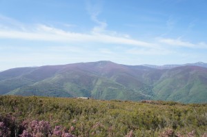
the view from the Rabanal pass was spectacular — heather coated mountains for miles under mostly clear blue skies. I was inclined to day that the stretch from Astorga to O’Cebriero was one of the more picturesque of our Camino but, really, every day brought an impressive sight of one type or another.

Castillo de los Templarios

one of the more unexpected discoveries we made in the last stages of the Camino was the Castillo de los Templarios in Ponferrada, the last large town before entering the eagerly-anticipated province of Galicia. the modern city is situated at the convergence of the Sil an Boeza rivers in the middle of the Bierzo plain (known for wine, among other things!) though the earliest settlement on the site date from pre-Roman times. it thrived as a mining district under Roman control but suffered destruction with Visigoth and Moorish invasions prior to the 11th century. the name derives from a bridge, built to transport peregrinos over one of the rivers, that had reinforcing elements made of iron (Pons Ferrata = Iron Bridge).

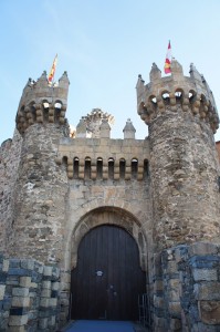
towards the end of the 12th century, the kingdom granted control of the city to the Knights Templar as a base from which they might protect peregrinos as they traversed the Camino. though the influence of the Templars proved short-lived (as they found themselves expelled from Spain about a century later), their legacy endures in the enormous Castillo de los Templarios perched on a hill overlooking the confluence of the two rivers. in 1178 Fernando II donated the ruins of a Roman (and later Visigoth) fort to the Templars for the purpose of building their own fortifications. they completed the massive structure (which now encompasses about 16,000 square meters, or more than 172,000 square feet) between 1218 and 1282 — insanely fast for something so expansive — but lost the castle some 20 years later when all the Templar Knights were placed under arrest by the Pope who ultimately dissolved the Order in 1312.

— an aside: in 2001 a researcher discovered a parchment in the Vatican archives that someone misfiled in 1628. dating from April of 1308, the “Chinon Parchment” demonstrates that, prior to completely dissolving the the Order, Pope Clement V absolved all the Templar Knights from the charges levied against them. compounded by other evidence on the issue, the Roman Catholic Church now acknowledges that the persecution of the Knights Templar was unjust, nothing in their order was inherently wrong, and that the Pope suffered undue pressure from the King of France (who was also his cousin).

after the Knights lost possession of the castle dispute over control raged for centuries, passing back and forth between noble and royal families and enduring sieges and attacks from all manner of opponents. in one more unbelievable series of exchanges, following an unfavorable judgement Rodrigo Osorio took control of the castle in 1483 in opposition to Fernando & Isabel; after a settlement he vacated temporarily in 1485 but shortly changed his mind and re-took the castle; the scenario repeated itself again in 1507, but Fernando, fed up with the game, finally confiscated the castle permanently for the Crown. in 1558 the caretaker appointed by the crown (the Marques de Villafranca) purchased the castle from the Crown; in the 17th and 18th centuries a city magistrate oversaw care of the castle on behalf of the Crown. in the early 19th century during the War of Independence it served as garrison and was once again attacked. in the 1850s, the city began to sell stones from the building for use in the construction of new buildings and sidewalks throughout the city. preservation and restoration began in the 1924 when the site received recognized status as a national landmark.

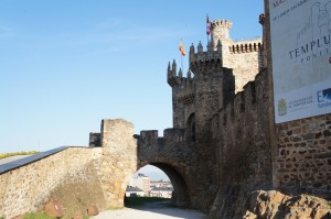
due to an unfortunate consequence of timing, we couldn’t do much beyond walk up to the (closed) front gate of the castle and then enjoy breakfast in view of its massive walls. if we’d read ahead more thoroughly and known the castle stood on our route we might have pushed on beyond Moliaseca and stayed in Ponferrada — it would have made the climb down from the Cruz de Ferro more challenging, but would have made the hot, challenging trek to Villafranca del Bierzo slightly less arduous. three more kilometers would have proven challenging, but … the castle was built in two phases — under the Templars in the 13th century and again under unknown direction in the 15th century. the south-facing entrance has a bridge over a moat and a double gate including barbican. the coats of arms over the front door illustrate the changing oversight of the castle.

voting from Spain

… voting in the June recall election.

one upside to going on a “planning binge” in early April was that by the time we left for Spain on May 4, I had the majority of our lodging planned out. it resulted in a more inflexible schedule for distances that we had to complete every day, but came with significant benefits — at least in my opinion. while traveling open ended certainly has its benefits, I’ve always been more of a planner and take comfort in knowing where I’ll bunk up each night. I’ve had fewer bad experiences with planned lodging than with unplanned lodging, but maybe that’s a question of my inability gauge a place on sight. on this particular journey, I found it far less stressful and emotionally taxing on the days I knew I had a bed to sleep in. even if it turned out to be an uncomfortable mattress with terrible pillows and no climate control or cross-breeze.

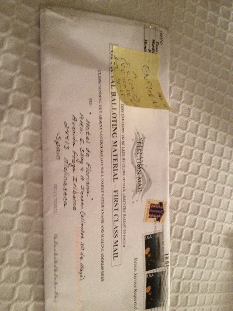
another benefit to having places planned out — we were able to have absentee ballots for the recall election sent to us! it took us a couple of days to get postage to return them, but it was a thrill to arrive and ask the woman checking us in (in muddled Spanish) if there was any mail addressed to our attention. and there was! in the end, it looks like they might not have made it back on time to be counted (which is rather despairing) but it was exhilarating to be able to exercise our right to vote from someplace so far away in a period when the shape of our daily lives took a shape so outside the ordinary. it’s one of those times where you feel the scope of your freedom and importance of your voice.

coming down the hill to Molinaseca

one of the more memorable things about the day coming the Cruz de Ferro after leaving Rabanal was how many more peregrinos there seemed to be than in previous days. the number had been growing, to be sure, since we’d gone through Astorga, but the number struck me on day 25 — perhaps because there were so many new faces, not all of which were welcome additions to the rotation of walking companions.

this last leg quickly became a test of patience when it came to new faces who had yet to grow accustomed to the hardships posed by the Camino (i.e. blisters). one woman we encountered on the descent did.not.stop.talking. the entire climb down to Molinaseca. after following along behind her for about 30 minutes as she regaled her companion with all manner of stories about her children, life, work, anything, I discovered (in having to sit at an adjoining table at the only cafe in town where we stopped for a mid-morning snack) that she’d only know said companion for a matter of hours! the majority of which, presumably, she’d been pouring out her life story heedless of her companions attention or interest (but what do I know, perhaps that “unsuspecting companion” was approaching all manner of peregrinos soliciting life stories and this Canadian woman was happy to oblige [yes, I know she was Canadian. I couldn’t help learning that she was Canadian]).

it was a warm day and the downhill grade was a different, if not entirely welcome, challenge after crossing the mesetas. we passed through two small villages, both hosting albergues and other lodging , though clearly struggling or abandoned outside the immediate radius of those establishments. the buildings were older and wood timbered; the two-story stone buildings lining the through-road in the first village had overhanging second floors, sticking out slightly over the narrow, cobbled road. the second village was much the same; it was an interesting approach and exit — not unlike walking through someones back yard or along the edge of someones property to get into town, which felt different in comparison to all the times we approached via the road into town that has been the road into town since Roman times.

as a counterpoint to Rabanal, Molinaseca also served as an important point along the trail of Roman gold. the town sits at the base of a gorge created by the rio Meruelo. as we crossed over the river on one of the two remaining medieval bridges, we saw a pair of women — obviously peregrinos, probably much newer to the Camino than us — wading in the water. previously we’d heard cautions against wading in water with which you weren’t familiar; with all the potential infection sites peregrinos might develop on their feet, seemed like sound advice no matter how refreshing a wade in a cool mountain-fed stream might sound.

by the 13th century, the town had transferred from the control of one monastery to another, and the latter granted a charter that provided favorable business terms for Frankish businessmen who catered in large part to the peregrinos heading into the last leg of their Camino. a number of structures dating from this period remain today, and the main street (down which we walked, from the river to the outskirts of town where our more modern hotel stood) was lined by two-story buildings in various states of restoration or disrepair. some rented out rooms, some contained narrow, packed shops, and a couple housed the first wine caves we encountered in the Bierzo region. not your typical tourist-friendly rooms like those you’d see in Napa, the Hunter Valley, or anywhere else known for its wine tasting …

in all, Molinaseca was a nice place to rest, rather than pushing on; true, spending the night in Ponferrada might have granted us an opportunity to visit the Castillo de los Templarios, but Molinaseca provided us with wonderfully comfortable beds, a chat with the Australian couple we’d met back in San Martin, “dinner” with a blue-eyed gray cat, and the opportunity to exercise a civic duty …

Foncebadón

something we saw increasingly as we headed from León to Galicia were completely abandoned villages, or villages with two or even one permanent resident. this concept came up for the first time as we walked through the first town beyond Rabanal del Camino — Foncebadón. whereas Rabanal had not only several albergues, two hotels, casa rurales, a neighborhood store, and two cafes its closest neighbor only boasted  three small, moderately-equipped albergues, one of which also served as the town’s only pub.

during the middle ages, however, the town flourished, nestled on a sheltered ridge just below the pass over the Irago Mountains on the Roman-built road that wends its way towards the gold mines of Bierzo in one direction and far distant Italy in the other. for a time, it was the preferred (and only safe) route and received approval and development support from a number of monarchs over the centuries. vivacity of the town dwindled steadily from about the 16th century as the stream of peregrinos slowed; wars and new roads kept people away or sent the few travelers along other paths over the mountains.

by the early 1970s not only were most of the peregrinos gone, but so were virtually all inhabitants. as one of my guidebooks put it, in 1974, the village was in its “death throes” with only 4 inhabitants tending a couple of cows and sheep; by 1990 it was only a mother and son. — “Our pilgrims were permitted to lay sleeping bags on straw in one of the two houses in the village still having a semblance of a roof.” it sounded as if the buildings of Foncebadón crumbled and collapsed with each successive group they shepherded along the Camino until virtually nothing structurally reliable remained. all of which is to explain why we opted for Rabanal instead of hiking the extra 6 kilometers to this near ghost town.

staying over would have probably proven a unique Camino experience; at least we wouldn’t have needed to sleep out in the elements… (which gets me thinking — where along the Camino did Martin Sheen and his companions have to sleep outdoors? perhaps reason enough to go back and watch it to determine if I can pinpoint the general vicinity.) we ran into the Australian couple from San Martin while noshing in Molinaseca (our destination this day) and they related their experience of staying overnight in Foncebadón. very quite and somewhat eerie are the terms that come to mind. as I said, there are some refurbished buildings to cater to peregrinos, but more remain abandoned. in the second picture above you can see the patchwork metal roof on the left barely keeping out the weather and, presumably, just keeping the building from giving up sooner rather than later.

as for the cross in the above image, I forget the origins — perhaps something to do with erecting crosses in order to get a tax exemption — but there were signs asking peregrinos not to leave rocks at the base of each. two kilometers beyond the village is the Cruz de Ferro (about which more shortly) where the growing mound is an important Camino milestone and where people are invited to leave behind pebbles. for the few villagers, however, it seems an undue additional burden to keep the non-Cruz-de-Ferro free of pebbles from over-eager peregrinos.