 I’ve heard that expression before “driving down the Keys,” but never fully appreciated what it meant before. you’d think “archipelago, obviously it’s a bit of a drive” and yet … I was also surprised at how quickly we got out of Miami and onto the coastal highway. once we cleared the snarly right outside the airport, it was a nice, easy drive with only a slow-moving gawker or two.
in its early days, Key West was a bustling town as it was so accessible by water; even before Henry Flagler built his railroad link, the city was home to 30,000 residents. Flagler developed an interest in Florida towards the end of the 19th century and became a resort developer, constructing a series of hotels down the east coast, culminating with the Casa Marina hotel in Key West.
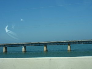 initially, the Overseas Railway was referred to as “Flagler’s Folly” — who’d think that a 128 mile extension over a coral archipelago would succeed? it necessitated immense amounts of labor, as well as innovations in railway construction. work began in 1905 and trains began running to Key West in 1912. hurricanes disrupted progress in 1906, 1909, and 1910 and, ultimately, destroyed it. trains rain until 1935, when the Labor Day Hurricane struck at Islamorada and swept away several sections of bridge, in addition to killing nearly 400 people. the company didn’t have finances to repair or replace the damaged sections and, eventually, they sold the remaining tracks and roadbed to the State of Florida, which turned the route into the highway it is today. while many of the bridges were replaced in the 1980s some remain as pedestrian and fishing bridges. you could tell the locals — bronze figures either running along otherwise desolate stretches of concrete, or planted in one of the fishing alcoves with a rod or two.
portions of the road were tolled until 1954. the Seven Mile Bridge was one of the longest bridges when it was constructed and once crossed over Pigeon Key (home to Flagler’s railway company) but now bypasses it as the original structure is unsafe for vehicular travel. the road, now designated U.S. 1 runs from Key West to Fort Kent in Maine.
I’m thankful that we ended up making the drive while it was sunny out. being on the road, with the water on both sides and the sun beating down, set the tone for the weekend wonderfully.
