Point Sur Lightstation

the Point Sur Lighthouse stands atop a tall rock outcropping at the head of Point Sur, about 130 miles south of San Francisco on the Pacific Coast Highway. not surprisingly, the point has proved dangerous for vessels as long as they have traveled the Pacific coast of the U.S., with over a dozen notable wrecks – initially spurred in part by the increased traffic associated with the gold rush – between the 1890s and 1960s. beginning in 1874, following the wreck of the USS Ventura, the United States Lighthouse Service began campaigning for a light at Point Sur, arguing that of all the spots along the California coast still in need of safety measures, Point Sur was of the “greatest importance.” in conjunction with citizen petitions, USLS lobbying eventually prompted Congress to approve $50,000 for construction of a lighthouse in 1886, with an additional $50,000 allocated in 1887. Point Sur Lighthouse
the resulting lighthouse and associated structures (which technically make Point Sur a lightstation) was built by a 25-man team over 1888 and was lit for the first time in August 1889, featuring a first-order Fresnel lens. life for the keeper, three assistants and their families was very isolated – moreso than Point Loma for sure – with the road to Monterrey often impassable and with resupplies coming in by boat every four months or so. for the most part, they had to be entirely self-sufficient.

the light and foghorn remain operational today, with both being updated to current technology by the Coast Guard in 1972 (the light was automated; the foghorn replaced with the impressive sounding “Super Tyfon Double Fog Signal” that can be heard up to 3 nautical miles distant). the last keeper left Point Sur in 1974. now, the Coast Guard services the station, but it is part of the Point Sur State Historic Park, run by the California Department of Parks and Recreation.
the James band in South Dakota

on September 7, 1876, after a disastrous attempt at robbing a bank in Northfield, Minnesota, the James band fled to the rugged land of the eastern Dakota territories. they took shelter in a cave along the Split Rock Creek. of all the men involved in the raid, only Frank and Jesse remained alive and at liberty in the end. after holing up in the creek-side cave for several days, hoping that their pursuers would overlook them and move westward or give up the pursuit, thus allowing the remaining gang members to slip away. unfortunately for Jesse, however, the posse remained and saw the men emerge. legend has it that, in order to successfully thwart the angered pursuers, Jesse jumped his horse over the Split Rock Creek, at a Devil’s Gulch, closer to the town of Garretson, where the gap between the cliffs over the creek narrowed.

info from Palisades SPtown of Garretson, and Wikipedia

Palisades State Park

on my recent trip to South Dakota, the weather proved infinitely more agreeable for “outdoor activities” than it had been in January. still windy. very windy. but much, much warmer.

on Saturday, we set out for Palisades State Park, located just northeast of Sioux Falls in Garretson. the Split Rock Creek flows between the pink quartzite walls of the canyon, which rise between 30 and 50 feet from the surface creek. in the U.S., major quartzite formations are found in central Texas, Utah, southwest Minnesota and eastern South Dakota, and the Baraboo Hills of Wisconsin. these particular rock formations are somewhere around 1.2 billion years old and is one of the only places in the country to contain catlinite (also known as pipestone), which is used by native peoples to create peace pipes. apparently, several pipestone quarries can be found within the park (we stuck to walking along the Creek and climbing the rocks).

because of the quartzite cliffs, Palisades State Park offers excellent rock climbing opportunities (not unlike Devil’s Lake) and, despite not having any proper equipment, the three of us took the opportunity to scramble up the “Queen” spire. (the picture below is of the “King”, from where we stood atop the “Queen”.) Josie, with her much longer legs, managed to get up onto the very highest point of the spire, while Rebecca and I settled for slightly lower perches.

during the 19th century, there was a huge flour mill overlooking the bluffs and the town of Palisades bustled on the banks of the creek. in 1886, silver was discovered downstream and produced a short-lived boom (the ore turned out to be of poor quality). several years later, the railroad company built a switching yard where Garretson is now located and the town relocated. railroad officials offered free lots to business owners located in Palisades to relocate to the new town.

info from the South Dakota state park system and from the town of Garretson

the sky goes on for days

yesterday I had a sudden and strong desire to be driving through the mountains on the way to/from Julian. whenever I needed to get away from San Diego for a while, I’d take to the hills. drive a loop that would take me up through Poway, and the fire-scorched land around Ramona, Santa Ysable and Wynola. sometimes I’d double back through Ramona, but more often I’d take the twisty turny mountainy road down through Cuyamaca Rancho State Park. the land to the east and south of Julian is devoted to parklands — Cuyamaca, Cleveland National Forest, and Anza-Borrego Desert State Park/Wilderness. on days like the one when I took this picture, the sky is an amazing gradient of blues, from the whispy white-blue near the horizon to an incredible azure above your head. it’s also a drive that requires your attention — switchbacks, narrow roads, blind curves. one of my favorite places on that drive is a short stretch through real (Californian) forest (with actual trees and low scrub brush, much more reminiscent of forests I am used to), where there are two curves that turn back on themselves and you drop your speed down to near nothing. take them a little on the speedy side and it’s a thrill.


Cuyamaca State Park association

tidal marsh and prairieland

some of the fleeing Mexican troops stumbled into tidal marsh land and drowned. there’s been significant subsidence of the marsh land over the last hundred years as exploitation of oil has increased and changes have been made to the San Jacinto River, Houston waterway, and the surrounding bays. there’s a nature trail through the area now — coastal prairie, tidal marsh, and bottomland forest. less than 1% of the original prairie remains, though at the time of the battle the area was covered with prairie grasses, much of which stood as high as the bellies of horses.

just beyond the prairie and battlefield are tidal marshes, which spread down to the Galveston Bay. the marsh here was completely converted to open water — some 100 acres — towards the end of the twentieth century but was restored in the 90s by pumping clean sand and sediment into the marsh from the San Jacinto River (or Houston Shipping Channel). there’s a boardwalk over the marshes, with a platform from which you can see nearly the whole way to the Galveston Bay.

on our walk, we saw several types of bird prints, some snake prints, a group of young kids and their parents on a nature hike, lots of kinds of scat, and a dead possum. the kids were most interested in the scat and possum.

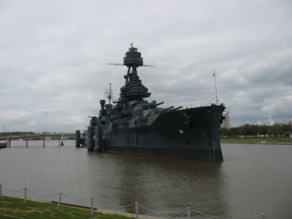
Battleship Texas

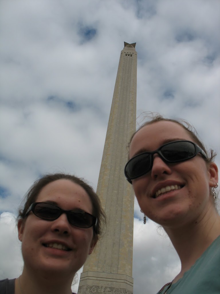
the Battleship Texas is moored in the Houston Shipping Channel, over the road from the San Jacinto monument and part of the State Park.
it was the only U.S. battleship to serve in both World Wars. brand new at the outbreak of the first one, it
helped launch troops for storming of the beaches at Normandy on D-Day.
arrived in Texas in April 1948 with the expressed intent of serving as a memorial. struck from the Naval Vessel Register on 21 April 1948, anniversary of the Texan victory at San Jacinto.
it first battleship memorial museum in the U.S. apparently the hull is not faring so well in the Channel and there is talk of building a dry dock to house it. we didn’t want to pay the $15 to get over the bridge and onto the ship. after several trips to the USS Midway, the USS Texas just didn’t quite compare.

San Jacinto

arriving into Houston late on Friday night, we headed to bed early for a full day of exploring on Saturday. first stop, the San Jacinto State Park, battle site where Texas won independence from Mexico in April of 1836. (Texas formally declared independence 174 years ago yesterday.)
San Jacinto was the last in a series of battles/sieges/massacres that also included that famous one in San Antonio, as well as less famous one in Goliad. (Goliad’s population in the 2000 census: 1,975.) the Mexican forces were commanded by President Antonio-Lopez de Santa Anna and Sam Houston led the Texans. the battle proper lasted 18 minutes, but, amped up and interested in meting out some vengeance for Alamo and Goliad, the Texan forces kept going for another hour. in the end, some 800 Mexicans were wounded or killed (many, many of those once the confrontation was “concluded”), while 39 Texans were killed and wounded.
Santa Anna was captured and held as a prisoner of war (a fact mentioned on the inscription on the outside of the monument — Santa Anna was granted a reprieve that he did not grant Texans at the Alamo or Goliad). during his captivity, Santa Anna signed the Treaty of Velasco, in which he agreed to remove troops from Texan soil.