Kolb Studios

the morning after our arrival at the Grand Canyon, we’d hoped to hike part way down the Bright Angel Trail into the canyon. unfortunately, the snow that had fallen in previous days had packed down on the shaded trail and both signs and rangers warned that crampons or some other method of “traction control” were strongly recommended.

disinclined to fork out the inflated price for Yaktrax, we opted to hike along the South Rim instead, from the Kolb Studio at the Grand Canyon Village back to the Visitor’s Center. I’m glad we made the effort to trek around the construction blocking access to the Bright Angel Trailhead, at the top of which perches the Kolb Studios.

Studio from the Bright Angel Trailhead

for those of you familiar with the Wisconsin Dells, the Kolb Brothers (Emery and Ellsworth) were to the Grand Canyon as H.H. Bennett was to the Dells, taking remarkable, breathtaking daring shots of the natural wonder of the Canyon and Colorado River. the brothers arrived at the Canyon in 1901 and 1902, one working as a bellhop in the lodge and the other hoping for work in an asbestos mine. fortunately for Emery, the mine had closed by his arrival and he stumbled upon a photography shop for sale in Williams; having previously dabbled in photography, he took the risk of the sale and began snapping shots of visitors winding their way down the Bright Angel Trail on mule trains.

initially, they operated out of a tent studio on the rim of the canyon. with the success of their business, however, allowed them to carve a shelf out of the canyon rim and construct a permanent building, which stands today as the core of the studio and museum. the studio grew through several additions including, most importantly, an auditorium in which the brothers screened the film that made them famous. though Ellsworth moved west to Los Angeles in 1924, Emery continued to run the studio and screen the film until his death in 1976, making it the longest, continually-running motion picture in the history.

the Kolb Brother’s canvas boat with cork life vest

after enjoying wide success from unique photos from the base of the Canyon and along the River, in 1911 the brothers undertook to navigate the Green and Colorado Rivers, through the Grand Canyon, eventually ending in Needles, California. the expedition took two months and they took the resulting moving picture show, the “Grand Canyon Film Show,” on tour across the country, playing to packed houses from Los Angeles to Chicago to New York City. upon returning from the screening tour, Ellsworth bought another boat and rode the spring flood from Needles to the Gulf of California, and recounted the entire adventure in the still-in-print Through the Grand Canyon from Wyoming to Mexico.

as I said, Emery stayed and worked in the studio until his death, continuing to photograph the Canyon and Rim as it became increasingly popular with tourists, changing and growing around him. proceeds from the studio and his photography helped support the entire family.

for more images of the studio, as well as the current exhibit in the studio on the Kolb Brothers, check out the National Park’s photostream.
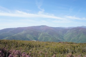
heather-coated mountains

the view from the Rabanal pass was spectacular — heather coated mountains for miles under mostly clear blue skies. I was inclined to day that the stretch from Astorga to O’Cebriero was one of the more picturesque of our Camino but, really, every day brought an impressive sight of one type or another.

enjoying the National Parks

growing up, our vacations almost always had an historical or natural focus to them — lots of national parks/monuments/forests. my sister and I even got “National Park Passports” at one point to collect stamps from all the places we visited. I still have it, but don’t carry it around and don’t usually pick up stamps on slips of paper when I visit places these days. as with a lot of my “standard” childhood experiences, I tend to think people my age went on similar road trips with their parents — unwillingly made to learn things on vacation. (Becca’s family took those kinds of trips, so I’m not totally off base.) it always surprises me a little when it arises in conversation that people haven’t been to iconic National Parks, like Mount Rushmore, or the Grand Canyon since, in my mind, they’re powerful visual representations of the U.S.
of course, lots of National Parks (including Mount Rushmore) are quite far from anywhere and, while there are lots of other National Parks in close proximity to Rushmore, those areas of the country have to be your destination. part of what makes them so great is their inaccessibility — it preserves the natural elements that made them worth preserving in the first place. 
the first effort to preserve natural landmarks for the benefit of the nation came in 1832, when Andrew Jackson set aside land to protect hot springs in Arkansas. the federal government wasn’t given any legal authority over the land, though, and control wasn’t sorted out until 1877. Yosemite was the first true national park; established in 1872 from land within federal territories, at the time there were no local governmental authorities that could take responsibility for the preservation of the valley, which consequently fell to the federal government. it succeeded in part because the Northern Pacific Railroad saw the financial benefits of creating a major tourist destination on their rail line and their support helped legislation pass Congress. 
initially, each national park was managed independently but because of the discrepancies in quality of management, Stephen Mather petition the government to develop a singular authority. in 1916, Woodrow Wilson signed legislation that created what is now the National Parks Service. in 1933, Franklin Roosevelt reorganized the Executive Branch to consolidate responsibility for the growing number of federally protected parks/monuments/memorials/cemeteries/etc. under the jurisdiction of one office. prior to this reorganization, for example, the War Department oversaw National Military Sites (e.g. Gettysburg, Revolutionary War battle sites) and one line of National Monuments (which included Cabrillo National Monument in San Diego), while the Department of Agriculture oversaw another line National Monuments (which included Gila Cliff Dwellings in  New Mexico and the Grand Canyon, among others). following the reorganization in 1933, there were 137 sites under the administration of the National Parks Service. today, there are 392 sites, most of which are National Historic Parks/Sites (123) but the National Parks see nearly twice as many visitors. while the largest ones are out west (not surprisingly), there are sites in every state and territory — which means no one has an excuse for not visiting at least one. find the one closest to you or, even better, plan a road trip!

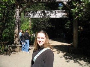
Muir Woods

back in April, one of my best friends got married in Muir Woods and she asked me to officiate. the entire week in San Francisco was great and the location they selected truly unique. as with Becca and Dave’s ceremony at Devil’s Lake, it was great to be outside and fun to be tramping through nature in wedding-formal attire.

I visited Muir Woods once previously; on my first trip to California the summer between my junior and senior years of high school, my mom and I drove up from San Francisco to check out the redwoods. at one time, redwood forests covered much of the coast of northern California but during the late 19th century logging cleared much of the timber. a stand of old growth trees remained untouched north of San Francisco along Redwood Creek, due primarily to its relative inaccessibility (the main road from San Francisco to the National Monument is still a steep and windy thing). concerned for the safety of the redwood grove, in 1905 Congressman William Kent and his wife Elizabeth secured a loan from a sympathetic banker friend and purchased 611 acres of land for $45,000.

being held by private hands did not ensure the safety of the grove, however. in 1907 a water company in Sausalito unveiled plans to dam Redwood Creek and flood the valley and heart of the redwood grove. to circumvent the problem posed by local court proceedings brought by the water company, Kent donated 295 acres to the federal government and in January 1908, Theodore Roosevelt established the Muir Woods National Monument under the auspices of the 1906 Antiquities Act. Muir Woods became the 7th National Monument and the first created from lands donated by a private individual. the name for the site came at the recommendation of Kent who objected to having the site named after himself. as Muir was instrumental in establishing the national parks system, Kent later proved instrumental in establishing the National Parks Service and, in 1928, a 280 foot Douglas fir was named in his honor (after decades of environmental buffeting, the tree toppled in 2003 and remains where it fell).

despite the inaccessibility that initially kept the redwoods safe, the Monument enjoys immense popularity due in part to its proximity to San Francisco. when the Golden Gate Bridge opened in 1937, attendance at the park tripled (to 180,000). it now receives more than three-quarters of a million visitors a year. our little troop accounted for at least a few of those visitors over the two days we went up to rehearse and conduct Lindsey & Andy’s wedding ceremony!

kayaking the Vltava

another incalculable upside to visiting Krumlov in late September? even in the absolutely perfect weather, I had the whole Vltava River to myself.

because of the town’s location in a crook of the Vltava river, water sports (along with all other manner of outdoor activity — I told you, the Czech enjoy the outdoors) are quite popular and several companies offer kayak and canoe rentals. both my guidebooks recommended getting out on the water, so on my (unanticipated) third day in Krumlov I tracked down one that rented single kayaks.

looking back at the Vltava from the direction I came

I showed up just as the shop opened and, upon hearing that I — a single person — wanted to rent a single kayak received a dubious look that could have wilted fresh flowers. “You know,” the rental guy said, “it really is better to have someone to go with you, take a two-person kayak.” I am not generally one to get legitimately offended by anyone, but the incredulity with which this guy infused his words struck me. I have kayaked, I have canoed, I have dealt with mild rapids and know how to handle myself. so I told him as much and made it clear that I intended to go no matter what he might think.

so I did (though not until a couple of hours later, when they brought boats into town from the boathouse). I passed sites along the river that, during the high season, offer refreshment (beer) and camping; late September, though, they were all closed. the water was calm and mostly quite shallow. I encountered a few rough patches, had to portage around the weir in town and battled a tendency to turn myself backwards from overcompensating my strokes; but on the whole my biggest concern stemmed from the fact that neoprene does have a saturation point and, upon reaching that point, water leaked through the skirt and soaked through my pants. good thing I opted for my quick-drying pants rather than jeans and against taking the option to bike back to town from the pick-up point in Zlata Koruna.

Posted by Picasa

Palisades State Park

on my recent trip to South Dakota, the weather proved infinitely more agreeable for “outdoor activities” than it had been in January. still windy. very windy. but much, much warmer.

on Saturday, we set out for Palisades State Park, located just northeast of Sioux Falls in Garretson. the Split Rock Creek flows between the pink quartzite walls of the canyon, which rise between 30 and 50 feet from the surface creek. in the U.S., major quartzite formations are found in central Texas, Utah, southwest Minnesota and eastern South Dakota, and the Baraboo Hills of Wisconsin. these particular rock formations are somewhere around 1.2 billion years old and is one of the only places in the country to contain catlinite (also known as pipestone), which is used by native peoples to create peace pipes. apparently, several pipestone quarries can be found within the park (we stuck to walking along the Creek and climbing the rocks).

because of the quartzite cliffs, Palisades State Park offers excellent rock climbing opportunities (not unlike Devil’s Lake) and, despite not having any proper equipment, the three of us took the opportunity to scramble up the “Queen” spire. (the picture below is of the “King”, from where we stood atop the “Queen”.) Josie, with her much longer legs, managed to get up onto the very highest point of the spire, while Rebecca and I settled for slightly lower perches.

during the 19th century, there was a huge flour mill overlooking the bluffs and the town of Palisades bustled on the banks of the creek. in 1886, silver was discovered downstream and produced a short-lived boom (the ore turned out to be of poor quality). several years later, the railroad company built a switching yard where Garretson is now located and the town relocated. railroad officials offered free lots to business owners located in Palisades to relocate to the new town.

info from the South Dakota state park system and from the town of Garretson