Brompton Cemetery

apparently the summers of volunteering under duress rubbed off on me and, while studying in London, I got out and involved on a few projects including one tidying up around monuments and beating back brush at the Brompton Cemetery. on this occasion, I managed to trick Becca into joining me though now I don’t recall how. the film “Finding Neverland,” some of which filmed in and around the cemetery (as well as in Hyde Park) though I don’t think it was released before we volunteered. perhaps I had a sense that some degree of celebrity might rub off on us or something. the novelty of celebrity was still fresh at the time; while I’d seen a few celebrities up to this point — both around London and elsewhere — I’d never faced the inconveniences that can accompany movie sets. in addition to “Finding Neverland,” Brompton Cemetery has featured in numerous films, most recently in the first of Guy Ritchie’s two “Sherlock” films.

begun in 1836 and consecrated by the Bishop of London in 1840, Brompton is one of the oldest garden cemeteries in London. over 35,000 monuments mark the final resting places of some 205,000 people buried over the course of more than a century. while the park covers some 39 acres of land once belonging to the Lord Kensington, the cemetery had to close to burials between 1952 and 1996 due to space constraints; it has since begun allowing burials once again, however.

following the economic and commercial shifts on the Continent that resulted from Napoleon’s defeat at Waterloo, the living population of London exploded in the early-mid 19th century — as did the dead population. the rapid increase in number of necessary burials necessitated more burial space. designed by Benjamin Baud, Brompton is one of seven cemeteries constructed around what was the outskirts of London in the mid-19th century in response to health hazards posed by the existing overburdened, overflowing, inner-city burial grounds. it’s central chapel was modeled on St. Peter’s Basilica and features impressive colonnades, catacombs, and private mausoleums. for whatever reason, the catacombs never attracted much interest and most of the spots remain unoccupied.

some interesting facts about the cemetery before wrapping up: Beatrix Potter took naming inspiration from headstones in the cemetery; several Native Americans were once buried in the cemetery following their unexpected and untimely deaths while touring in England (as part of Buffalo Bill’s Wild West Show). after researchers in the late twentieth century traced the families of two of the men (Chief Long Wolf and Paul Eagle Star, both Sioux), their remains were returned to tribal territory in the United States for reburial.

turns out I don’t have any photos of our afternoon of weeding, but here’s a video tour of Brompton Cemetery if you’re interested in seeing what it looks like.
Canterbury’s Norman Castle

first stop on this Great Britain tour is the Norman Castle in Canterbury; seeing the Cliffs of Dover in one of the top-of-the-hour teaser videos actually inspired me to write about my adventures.

my trip to Canterbury is probably the one that has come up most often in the intervening years — one of my early misadventures that resulted in an interesting anecdote. Becca and I set off on one of our days off with an eye to visiting the site where, as one of our high school history teachers regaled us, Sir Thomas Becket was gruesomely martyred by men loyal to Henry II. (whether Henry II called for the hit remains a matter of hotly contested historical debate.) 

the day started out well enough, catching a train from Waterloo station towards Dover, but got complicated in short order. we failed to change trains at a key juncture — who knew that garbled announcement we heard as the train paused in Ashford directed us to change to another line for Canterbury? and deduced our mistake as the white cliffs of Dover rolled past the train window. thankfully, the return train towards London (via Ashford) departed within a few minutes of our unintended arrival and we successfully found ourselves in Canterbury a relatively short while later.

after a short visit to the Cathedral (possibly about which more later) we headed for the more interesting — to me at least — site of the Norman Castle, constructed shortly after the pivotal Battle of Hastings in 1066. following his victory at Hastings, William the Conqueror (aka William I) headed towards London via this road from Dover; to defend the road three motte-and-bailey castles were constructed, one of which stood on the site in Canterbury we visited.

the ruins we saw are from the stone keep constructed during the rein of Henry I. made of flint and sandstone chips, it was one three royal castles in Kent at the time; part of the enclosure reused the city wall originally constructed by the Romans.. by the 14th century, larger castles in Dover overshadowed this castle and it became a jail; by the 17th century it had fallen into ruin. it’s now owned and run by local authority and open to the public year round, which is why we were able to wander in and take a look around in the middle of a not-quite-drizzly afternoon.

the return journey, while successful, also presented an unwanted adventure that I’m sure at least one of us could have done without. all in all, though, I enjoyed the day trip and getting to see a structure that has seen innumerable changes over centuries and centuries.

Gavins Point Dam

on my most recent trip to Sioux Falls, our driving adventures took us out to Lewis & Clark State Park, situated on the banks of the Lewis & Clark Lake,  created by the Gavins Point Dam spanning the Missouri River. it’s kind of cool to go someplace that’s so obviously a summer-tourist-weekend-bonanza in the off season. no competition for parking, no dodging small children, no fighting off boat launchers for access to the jetty or to pose as Lewis & Clark on the launch docks.

although on our impromptu jaunt to the west of Yankton was aimed primarily at checking out the park, I managed to convince Becca to take a right along Crest Road that we might investigate the concrete structure on the south end. in a matter of minutes, we were back in Nebraska (again), crossing over the Gavins Point Dam. the hydroelectric dam that impounds Lewis & Clark Lake was constructed between 1954 and 1957 and was authorized as part of the 1944 Pick-Sloan Plan, aimed at conservation, control and use of water resources along the Missouri River Basin. it’s one of six dams on the Missouri River and (according to the US Army Corps of Engineers who maintains the site) produces electricity for some 65,000 people annually.

maybe a tour of the facility would have introduced me to the finer and/or more impressive points of the Gavins Point Dam (but as they’re only open Memorial-Labor Day …); maybe the sight is more awe-inspiring with water flowing over the dam; maybe sunlight glinting off the surface of the lake illuminates this architectural feat of utilitarianism in a mystical way; or maybe I’ll forever be underwhelmed by dams after staring down the slope of Hoover Dam. whatever the reason, I wouldn’t go out of my way to see the Gavins Point Dam again. especially not in the height of tourist season — it goes down to one lane as you pass the generator facility and I have no interest in sitting in that waiting line.

more than getting from point A to point B

this past weekend I headed up to Minneapolis to visit and see some friends, one of whom has lived there since moving up to attend the University of Minnesota, two of whom drove in from Sioux Falls to see Iron Man 2 on an IMAX screen. excellent excuses to get out of town all around.
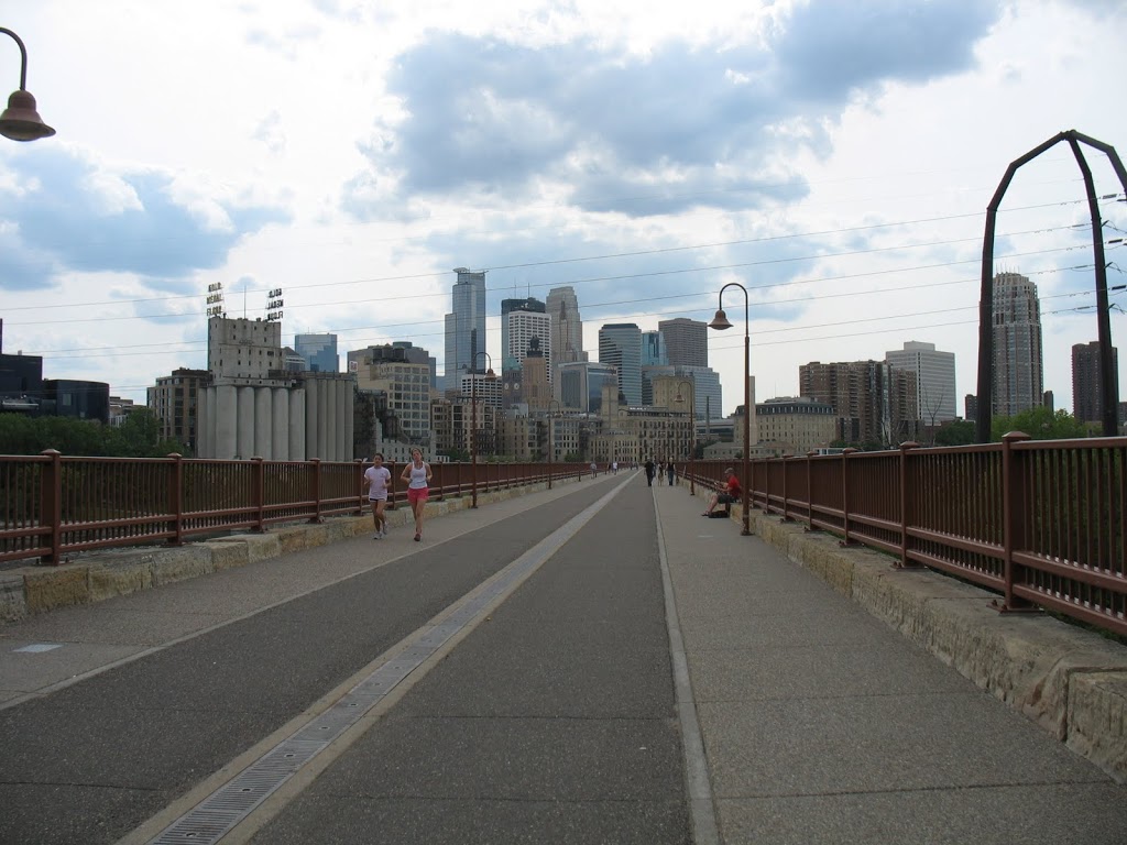
the unparalleled bonus of visiting friends who reside in new places is that (particularly the longer they’ve lived there) they’ve done much of the legwork in finding off-the-beaten path places to visit or things to do. my lovely Leah has gotten to know a lot of Minneapolis in the last *haruph* years and introduced me to one of her favorite places: the Stone Arch Bridge, which crosses the Mississippi River at the Saint Anthony Falls, heading into downtown. the bridge, built in 1883, originally carried two sets of railroad tracks for the Great Northern Railway; it carried trains, including the Empire Builder passenger train, over the river until 1978. it’s been repaired and refurbished over the years (obviously); when the Saint Anthony Falls lock and dam was built, two of the original stone spans were replaced by a steel one, which would allow larger ships to maneuver under the bridge. repairs were again necessary in 1965, when  floodwaters undermined three of the piers holding the 21 stone arches up and the bridge began to sag. restoration and re-purpose of the bridge to its current purpose began in the 1990s, and now the 28 foot wide, 2,176 foot long bridge serves as a pedestrian and bike connection between downtown and the eastern bank of the River. it also offers great views of the Saint Anthony Falls and Nicolet & Hennepin Island, as well downtown and old mills along both banks (the Mill City Museum, in the Washburn A Mill on the west, the abandoned Pillsbury A Mill on the east).
after walking out along the bridge, past a guy who was playing his guitar for change (but, it seemed, mostly for the joy of playing), Leah and I headed back to the east bank to enjoy a beer, the view, and the springtime weather. though I had to be attentive that puffy, wind-blown seeds didn’t end up in my beer, we couldn’t have asked for nicer weather. the three couples we saw getting engagement photos couldn’t complain, either. one set spent about twenty minutes in the same place, with the falls and 3rd Avenue bridge in the background. with another, you could tell that the woman was in charge of the shoot — her heels put her at just the right height to be nicely matched with him, and her fiance was decked out in loafers, khaki pants, a white dress shirt and a white suit coat. we didn’t wait around to see if they made any effort to forcibly eject the falls-bridge-background couple from the ideal photo location.

Palisades State Park

on my recent trip to South Dakota, the weather proved infinitely more agreeable for “outdoor activities” than it had been in January. still windy. very windy. but much, much warmer.

on Saturday, we set out for Palisades State Park, located just northeast of Sioux Falls in Garretson. the Split Rock Creek flows between the pink quartzite walls of the canyon, which rise between 30 and 50 feet from the surface creek. in the U.S., major quartzite formations are found in central Texas, Utah, southwest Minnesota and eastern South Dakota, and the Baraboo Hills of Wisconsin. these particular rock formations are somewhere around 1.2 billion years old and is one of the only places in the country to contain catlinite (also known as pipestone), which is used by native peoples to create peace pipes. apparently, several pipestone quarries can be found within the park (we stuck to walking along the Creek and climbing the rocks).

because of the quartzite cliffs, Palisades State Park offers excellent rock climbing opportunities (not unlike Devil’s Lake) and, despite not having any proper equipment, the three of us took the opportunity to scramble up the “Queen” spire. (the picture below is of the “King”, from where we stood atop the “Queen”.) Josie, with her much longer legs, managed to get up onto the very highest point of the spire, while Rebecca and I settled for slightly lower perches.

during the 19th century, there was a huge flour mill overlooking the bluffs and the town of Palisades bustled on the banks of the creek. in 1886, silver was discovered downstream and produced a short-lived boom (the ore turned out to be of poor quality). several years later, the railroad company built a switching yard where Garretson is now located and the town relocated. railroad officials offered free lots to business owners located in Palisades to relocate to the new town.

info from the South Dakota state park system and from the town of Garretson

auuuuuuuuuu Champs Elysee …

instead of taking the elevator and going up in the Eiffel Tower, Becca and I climbed the 284 steps to the top of the Arc de Triomphe.

totally worth it. again.

I first climbed to the top of the Arc de Triomphe at the age of 16, while visiting Paris at the beginning of a three-week tour with classmates from West. following the organized morning activity, Leah and I spent our afternoon at liberty walking from the Place de la Concorde, up the Champs Elysee, to the foot of the Arc de Triomphe, where we met up with the remainder of the group several hours later. a pair of American teenagers (and looking very much the part) meandering along the most famous boulevard in France, window shopping and commenting on the locals. the sun was setting as we reached the top, and I’ve got a fun picture of a group of us with the Tour Eiffel in the background, the sky fading to indigo at the horizon. (but not scanned onto my computer.)

 View Larger Map
(really, what did we do before google maps?! my mental map of Paris would be even better than it already is …)

the Arc de Triomphe stands in the center of the Place Charles de Gaulle and is the linchpin of the axis historique, a sequence of monuments and thoroughfares that runs from the heart of the Louvre to the outskirts of the city. it stands 50m high (160ft) and is the second highest triumphal arch in existence. after the victory parade following the end of World War I, a pilot flew his biplane through the center of the arch. it was commissioned in 1806 by Napoleon following his success at Austerlitz. during the Bourbon Restoration, construction on the Arc was halted, and it was not completed until the reign of Louis-Philippe in 1836.
the body of Victor Hugo lay out overnight in 1885 before he was buried in the Panteon. beneath the Arc is the Tomb of the Unknown Soldier from the First World War, inscribed with the phrase ICI REPOSE UN SOLDAT FRANÇAIS MORT POUR LA PATRIE 1914–1918 (“Here lies a French soldier who died for the fatherland 1914–1918”), which is also the site of the first eternal flame lit in Europe since the Vestal Virgin’s flame was extinguished in 394 CE.

the second time I visited the Arc de Triomphe, Becca and I climbed to the top as night fell. as it was mid-November, it grew dark well before the laser show put on at the Tour Eiffel, but we enjoyed all the lights offered by the City of Light. we climbed the 294 steps to the top and thoroughly enjoyed the panoramic view of nighttime Paris.

more, including information about the art and architecture from Wikipedia

pres de la Tour Eiffel

three times to Paris … three times to the Tour Eiffel … but only up in the elevators once. the most recent time, with Becca, was perhaps the most amusing. I don’t have particularly clear memories of the first two visits, apart from the fact that they were both during the day, and the second time we tried to figure out which riverside tunnel was the one in which Princess Diana died.

many Parisians decried the structure when it was completed in 1889 as an “eyesore” and, when asked why he ate lunch at the Tower’s restaurant every day, Guy de Maupassant explained that it was the only place in the city from which one could not see the tower (flimsy claim if you ask me). while it has become the quintessential landmark of the city, and depicted as visible from many an establishing-shot in movies, zoning regulations in Paris mean that very few buildings are actually tall enough to grant a clear view of the tower. initially, the construction contract called for the structure to be dismantled after twenty years, when ownership reverted to the city of Paris, but it proved valuable for communication purposes and remained standing. and now that it’s become part of the popular perception of the City of Light, more than 200 million people have visited the “eyesore”.

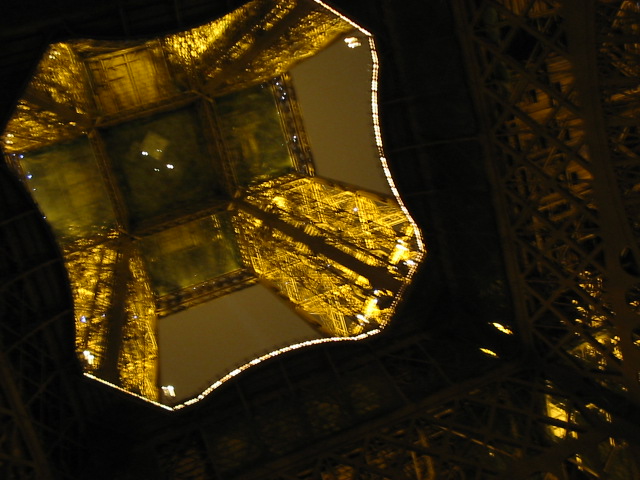
but Becca and I didn’t go up in the tower; we arrived after the elevators had closed down for the night. (we’d climbed up the Arc de Triomphe instead.) instead, we wandered around the park and gazed up the center of the tallest building in Paris. and as we headed back to the Metro, past Les Invalides, we were accosted good-naturedly by a middle-aged, local, hobo-looking gent (from what I remember — Becca correct me on this if you recall differently). I don’t recall precisely what he said, or how we responded, apart from something of the oh-how-gorgeous-you-two-young-ladies variety. what occurs to me now, in thinking back, is that stands as one of the few conversations during the weekend in which a French person began and continued a conversation with us in French. it seemed that everywhere else we went, everyone else we encountered, saw us and began in English, or heard our attempts at French and switched to English. (which was certainly not, for someone, who, at that point had spent seven years studying French and considered spending her study abroad experience in France, a welcome assumption or shift.) but this random lout, between the Tour Eiffel and Les Invalides, assumed and tolerated our French-language abilities.
and now, quite suddenly, after not thinking much about Paris in the intervening five and a half years, I would very much like to visit again.

more from Wikipedia and the Tower’s site

au Cimtiere du Pere Lachaise

the most authentically gothic cemetery I’ve ever visited was that of Pere Lachaise in Paris. even thinking of it now conjures up images from The Woman in White (which, I know, I know, is set in London). it was one of the first places that Becca and I visited on our weekend trip to Paris. westayed at this thoroughly budget (but clean, and really not that bad) hotel just a couple of blocks from the cemetery and got there early in the morning. it was autumn when we visited, and wonderfully sunny that day. there were fallen leaves everywhere, giving that wonderful leaf-kicking crunch.

the cemetery has wide boulevards, off of which you can find many of the big-name internments, like Oscar Wilde, Honore de Balzac, Georges Bizet, Chopin, Saint-Cyr, Marcel Marceau, Moliere, Jim Morrison, Edith Piaf, Pissaro, Proust, Seurat, and Richard Wright. but as we didn’t have much of a plan in mind, we wandered around the narrower paths of the cemetery.

established by Napoleon in 1804, Pere Lachaise is the largest cemetery within the city of Paris. it was named for Francios de la Chaise, confessor to Louis XIV. cemeteries had been banned within the city limits in 1786 on the premise that they posed a health hazard. this lead to the creation of the catacombs, as well as cemeteries that fell outside the boundaries of the capital (such as the one in Montmartre). initially, the distance of Pere Lachaise from the city center proved a major disincentive for funerals, so the administrators concocted a marketing campaign that, with great fanfare, transferred the remains of La Fontaine and Moliere to the cemetery. the move worked and, in 1817, they also orchestrated the relocation of the purported remains of Piere Abelard and Heloise to the cemetery. within a few years, internments went from a few dozen to more than 33,000. there are now over 300,000 “permanent residents” buried in the Cemetery, and even more cremated remains housed in the columbarium.

the Cemetery also has special meaning to the political left (apparently). in 1871, some 147 fédérés of the Paris Commune were shot and dumped into an open trench at the foot of a wall in the cemetery. leftist groups often hold parades through the grounds on the anniversary of the massacre (28 May), the largest of which took place in 1936 when some 600,000 people participated. in an ironic twist of fate, the man purportedly responsible for the events of the “Bloody Week” that culminated in the massacre at the Communards’ Wall (Adolphe Thiers) is also buried in Pere Lachaise.
(Pere Lachaise Cemetery on wikipedia and a tourist site)


one of my favorite things from our visit to Pere Lachaise, was this black cat. we actually saw several cats — surprise, surprise in a city full of feral cats — one of which disappeared into the tangle around a gated family tomb.