Stonehenge

 the other night we stumbled upon a NOVA episode exploring the logistics of constructing Stonehenge and how it connects to Durrington Walls up the River Avon. the heart of the portion we watched centered on one scholar’s theory about how the stones got to the famous site in the Salisbury Plain — placing the several-ton stones on platforms on tracks of milled timber with the equivalent of wood or stone ball bearings to allow the contraption to glide towards the destination. it was an interesting idea … for an age when modern milling and ball-bearings might be common, but I was inclined to agree with the criticism that it was perhaps a bit over-engineered for the Neolithic architects of Stonehenge. logs and lots of people with ropes seemed just as effective and perhaps more expeditious. but then, most of what we know about Stonehenge comes from educated guesses at best.

the earthwork enclosure that encompasses the site dates from about 3100 BCE while radiocarbon testing and other evidence suggest the stones were erected sometime between 3000 and 2000 BCE, with the bluestones (the smaller ones) perhaps going up towards the beginning of that period and the remaining sarsens (the larger ones) later on. Stonehenge was constructed in several phases over a some 1,500 years, replacing monuments that previously stood on the site.

one of the more impressive facts about the site is the distance the stones traveled. while the precise origin remains unknown, it seems the bluestones came from the Preseli Hills in southwest Wales more than 150 miles away from Stonehenge (another theory posits they were glacial erratics left much closer to the site by the Irish Sea Glacier). in 2011, researchers at the University of Wales announced they’d identified the exact source from which the earliest stones were taken — 140 miles away in Pembrokshire in Wales. the sarsen stones are made of a type of sandstone found throughout southwest England but most archaeologists believe these stones came from the Marlborough Downs about 30 miles distant. as I mentioned, the bluestones were erected first, likely in a double-circle, and show signs of human efforts to shape them to fit together in some fashion. the sarsens were worked at the site using handmade tools; the NOVA program included excavation of some of the tools and stone shards carved off the sarsens.

the first signs of inhabitants on the site, however — four or five pits (some which held pine posts) — were discovered in the site’s parking lot between the 1960s and 80s and date to sometime between 8500 and 7000 BCE (the Mesolithic era!). recently uncovered evidence suggests the site may have been used for burials from the beginning, with cremains found in and around pits along the bank and ditch; in the 64 identified burial sites archaeologists have found remains for as many as 150 individuals. the NOVA program also chronicled excavations along the banks of the River Avon by archaeologists, seeking to determine whether the avenue did, in fact, continue all the way to the river and thus, presumably, symbolically and physically connect Stonehenge with Durrington Walls up the river. based on the positioning of the two sites, the researchers proposed Durrington Walls as a “site of the living” (as it aligned with sunrise) while Stonehenge was a “site of the dead” (as it aligned with the sunset and was a site for burial).

beginning in the 1920s, the National Trust began purchasing land around Stonehenge to preserve the setting around the monument as early in the 20th century land nearby was increasingly turned to cultivation. since the 1980s, the National Trust has worked with local landowners to revert some of this previous farmland back to chalk grassland. the setting-preservation effort was undermined somewhat by the two roadways — the A344 and the A303. over the last several decades plans have repeatedly been advanced then shelved to close or reroute the two roads in order to return the atmosphere of the site to how it might have been millennia ago. in 2010, the Wiltshire Council approved plans for a new visitors center to replace the one built in the 1970s, but forward progress is currently held up by getting acquiescence to close the A344 and two other nearby roadways.

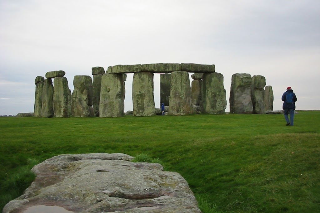
of course, the sheer volume of visitors will still affect how one experiences Stonehenge. at the turn of the 20th century, concern for visitor safety (coupled with the toppling of an outer sarsen and its lintel) prompted the then-owner to begin the process of re-erecting fallen stones and stabilising the bases of others. the site was donated to the nation in 1918 by Cecil Chubb (who’d purchased several years earlier in an auction) who became responsible for its upkeep and providing access. between 1938 and today, annual visitors to the site increased from 38,000 to over 900,000. in 1978, erosion of the earthworks due to the increased number of visitors and acts of vandalism to the stones resulted in access to the stones being restricted. today, visitors are only allowed to tour Stonehenge from roped-off paths that prevent too many people from accessing the stones at any given period.

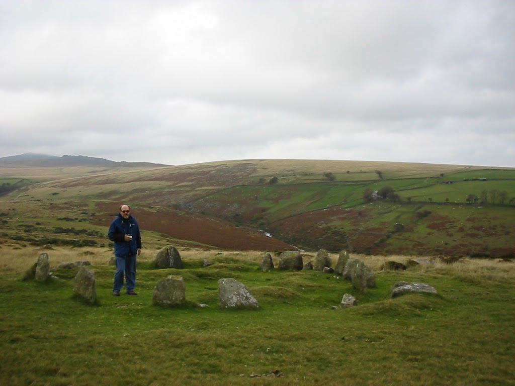
even though access to the stones is restricted, it isn’t prohibited; it just requires some planning, forethought, and approval from the National Trust. my dad was one with such foresight and managed to coordinate an early-Sunday-morning visit for us when my parents came to visit me while I was studying in London. it’s a truly unique experience to get such remarkable access to a monument so impressive, so old, and so shrouded in mystery. the first time I visited England, we focused more time on Avebury and (if I recall correctly) just stopped along the road and looked through the fence at Stonehenge, rather than paying the entrance fee to walk around the roped-off path. it was worth the wait, though, to get to to stand so close the stones, to touch them and walk among them. if you’re ever in the vicinity, I highly recommend taking the time to visit and, if you’ve got some foresight, too, plan ahead for one of those outside-operating-hours access spots.

some final thoughts:
if you’re in Ireland, you should definitely make the effort to visit Brú na Bóinne (it’s on the itinerary for the next trip to Ireland this summer!) another remarkable Neolithic site.
check out the NOVA program, Secrets of Stonehenge, for more on all the projects I referenced above.
lastly, one of my favorite travel blogs, Twenty-Something Travel, posts “Friday Postcards” and the one from this week was, coincidentally, Stonehenge at sunrise!

back to the blustery moors

eight years ago this week I returned from spending a semester studying in London. yesterday, prompted by a request for some pictures of standing out on the blustery moor to match the one posing with the Monumento do Peregrino in Galicia, I pulled out the journals from my study-abroad experience and looked back through my photos to find something suitably windswept. in fact, I found a photo of the Nine Maidens standing circle, which I hadn’t found to associate with my last post on the area.

stone circles are scattered across Dartmoor, including the one we visited, and contains the largest collection of Bronze Age tools anywhere in Britain. at that time, the climate was much warmer and trees likely covered much of the moorland, which were cleared by inhabitants using fire in order to make way for farm fields. as the climate cooled and people fled, the acidic soil they left behind made preservation of stone foundations and tools comparatively successful, thus resulting in the plethora of prehistoric tools. when things warmed up again, people returned and used many of the same tactics to construct needed buildings as they had before; some built in this longhouse style remain in use today (with modifications) though many lay abandoned and ruined.

one of the distinct features of Dartmoor are its numerous tors — hills topped with rock outcroppings similar to but markedly less famous than the one in Glastonbury. in early May each year, the British Army arranges a  weekend hike known as the Ten Tors in which youth between the ages of 14 and 19 complete circuits of 35, 45, or 55 miles (depending on age) in teams of six. according to the organizers it’s not technically a race, but more of an endurance test of survival and outdoor skills; obviously that doesn’t stop teams from competing with one another for the best time though. since there are a variety of potential routes, however, you won’t necessarily know which other teams might keep pace with you. the first race took place in 1960 with about 200 people; now participation is capped at 2,400 youth from southwest England. two noteworthy things happened during the 2012 event — the first all-girls team completed the course in a school-record time; and a team on track to complete in sixteen hours diverted upon hearing the distress calls of another team and ensured their rescue before crossing the finish twenty minutes after the official close of the race, which would have barred them from receiving recognition of completion. naturally, the director of the event acknowledged them anyway.

having spent an comparatively mild fall afternoon out on the moor, and reading about the variable if not downright tempestuous weather, it’s amazing to consider anyone would want to undertake a weekend of trekking around the moor, braving whatever the elements seek to dump on you. in more than a few years the weather has necessitated evacuation of teams at some point during the competition or outright cancellation prior to starting out.

Canterbury’s Norman Castle

first stop on this Great Britain tour is the Norman Castle in Canterbury; seeing the Cliffs of Dover in one of the top-of-the-hour teaser videos actually inspired me to write about my adventures.

my trip to Canterbury is probably the one that has come up most often in the intervening years — one of my early misadventures that resulted in an interesting anecdote. Becca and I set off on one of our days off with an eye to visiting the site where, as one of our high school history teachers regaled us, Sir Thomas Becket was gruesomely martyred by men loyal to Henry II. (whether Henry II called for the hit remains a matter of hotly contested historical debate.) 

the day started out well enough, catching a train from Waterloo station towards Dover, but got complicated in short order. we failed to change trains at a key juncture — who knew that garbled announcement we heard as the train paused in Ashford directed us to change to another line for Canterbury? and deduced our mistake as the white cliffs of Dover rolled past the train window. thankfully, the return train towards London (via Ashford) departed within a few minutes of our unintended arrival and we successfully found ourselves in Canterbury a relatively short while later.

after a short visit to the Cathedral (possibly about which more later) we headed for the more interesting — to me at least — site of the Norman Castle, constructed shortly after the pivotal Battle of Hastings in 1066. following his victory at Hastings, William the Conqueror (aka William I) headed towards London via this road from Dover; to defend the road three motte-and-bailey castles were constructed, one of which stood on the site in Canterbury we visited.

the ruins we saw are from the stone keep constructed during the rein of Henry I. made of flint and sandstone chips, it was one three royal castles in Kent at the time; part of the enclosure reused the city wall originally constructed by the Romans.. by the 14th century, larger castles in Dover overshadowed this castle and it became a jail; by the 17th century it had fallen into ruin. it’s now owned and run by local authority and open to the public year round, which is why we were able to wander in and take a look around in the middle of a not-quite-drizzly afternoon.

the return journey, while successful, also presented an unwanted adventure that I’m sure at least one of us could have done without. all in all, though, I enjoyed the day trip and getting to see a structure that has seen innumerable changes over centuries and centuries.

London 2012

and now a break from our current theme programming …

eight years ago, I was studying in England as London bid to host the 2012 Olympics. as a temporary local and twenty-one-year-old with only a vague understanding of what bidding for the Games entailed and could mean, few of the outwardly-visible self-promotion efforts the City made stuck with me. I remember there were special bid-themed seat covers on some of the Tube trains — that’s about it.

my elation that London won the bid was tempered by the 7/7 attacks and, to some extent, the latter took on greater prominence in my memory. the Olympic Games were a long way off (2012!? what kind of futuristic, mystical place is that?!) and 7/7 was more immediate. during the intervening years, the terrorist attack has faded and the excitement of the XXX Olympiad grew, in spite of the mishaps that threatened to overshadow any successes London might enjoy. missiles on residential buildings that will only work if it’s not cloudy? the ticketing debacle? poor London, it seemed, would never overcome the derision, gaffes and flubs.

yet somehow they did. for the most part. to some extent, I think the oddities of the Opening Ceremony were aided by the absurdity of how NBC edited the program for “American sensibilities”, but I believe Danny Boyle said something to the effect that because the Beijing Opening Ceremony was so spectacular, precise and over the top, it took some of the pressure of being supremely perfect off. he could focus more on developing a program that captured the British spirit.

I don’t remember much of anything about the Beijing Games; I’d just graduated from UCSD, was working crazy hours at two different jobs and searching for something full-time. I don’t know if I watched any of the Games, much less the Opening or Closing Ceremonies. maybe its the change in my circumstance that has me more engaged this time around, but it probably doesn’t hurt that I’m already plugged into a lot of British culture. one of my favorite podcasts is doing “micro-episodes” every day talking about the events one of the hosts is attending — events for sports that he has no particular interest in beyond the fact that they are a) sports, b) Olympic events, and c) happening in/around London (the first he went to was actually a soccer match held in Cardiff last week) I can’t imagine he’d trek across the globe and snatch up tickets to events anywhere else, but he’s so enthusiastic about all the elements associated with London 2012 that it’s infectious.

all this is to say that watching the Games have me thinking about my previous time in England, reminiscing and yearning to go back sooner rather than later. to assuage that itch, I’m going to do a few posts about my ’04 adventures — keep an eye out.

Albert Memorial Bridge

the Albert Memorial Bridge connects Battersea and Chelsea over the Thames and is pretty spectacular by night. it was designed and built in 1873, but the principals used in constructing the bridge proved it structurally unsound and, beginning in 1884, modifications were made over the course of three years to stabilise it. further reinforcements were introduced in 1973 (after a proposal to turn the entire bridge into a landscaped park with pedestrian access over the river failed), which makes the existing bridge a hybrid of three architectural styles.

the first bridge on the sight dates from 1771, when a wooden bridge connected industrial Chelsea with the rich farming village of Battersea. despite campaigns to demolish the bridge, even after the Victoria (now Chelsea) Bridge was completed downriver, the wooden bridge remained well into the 19th century, growing increasingly unstable, unpopular, and unsafe, while (not surprisingly) the Victoria Bridge became more congested. to rectify the congestion, Prince Albert recommended the construction of a toll bridge between the two existing bridges; predictably, the operators of the decrepit Battersea Bridge opposed the new bridge as it might diminish their custom (one wonders whether they recognized the connection between the derelict quality of their bridge and a decline in customers …), but a compromise (whereby the owners of the new Albert Bridge would purchase the Battersea Bridge upon completion of the former) authorization to begin construction on the new structure came in 1864. the man selected to design it, Rowland Mason Ordish, also designed the Royal Albert Hall, St. Pancras railway station, the Crystal Palace, and Holborn Viaduct. delays in completing the Chelsea Embankment blocked the project, however; in the intervening six years, Ordish designed the Franz Josef Bridge in Prague (said to be a model for the Albert Memorial), and the bridge owners were required to obtain another Act of Parliament before finally beginning construction in 1870. predicted to last about a year and come in under 70,000 GBP, naturally the project ran three times longer than expected and nearly three times more expensive.

in part because of the original agreement with the owners of the Battersea Bridge, the new Albert Bridge opened already deep in the hole and, consequently, never proved financially successful. the expense of paying off the rickety wooden bridge owners drained many of the resources intended for improving the traffic approach on either side of the new Albert Bridge, making it more difficult to access even as it struggled to compete with the Victoria Bridge, which remained more popular as it allowed for closer access to the center of London. after operating as a toll bridge for 7 years, the Metropolis Toll Bridges Act allowed the City to purchase both the Albert and Battersea Bridges for a paltry sum and remove the tolls. the tollbooths remain at either end of the bridge, however, and are the only ones remaining on bridges in London.

as with the Millennium Bridge (and probably any other pedestrian-use-heavy bridge) the Albert Bridge also has trouble with vibrations when large numbers of people cross at one time. these concerns prompted the placement of signs at the entrance warning troops from the Chelasea Barracks (actually closer to the Victoria/Chelsea Bridge, and which were vacated in 2006) to break step when crossing.

though it was painted uniform colors for the first century of use, in the late 20th century, a new pink, blue, and green color scheme was selected in an effort to make it more visible in foggy weather. additionally, some 4,000 lights were added to illuminate the structure, effectively turning it into a recognizable landmark of west London. along with the Tower Bridge, the Albert Bridge is the only Thames London bridge never to be replaced, and in 1975 was given protection as a “listed structure” (which prevents modification without “consultation). however, because of changing use patterns, increased weight of vehicles, and the fact that it wasn’t designed to carry automobiles in the volume it now sees, the bridge continues to deteriorate. in order to refurbish and strengthen the structure, the Bridge was closed in February of this year.

a decent entry on Wikipedia


View Larger Map

Millennium Bridge

oh, Millennium Bridge, you landmark that left a little blemish of embarrassment on London’s face (but not as big as the Millennium Dome, which might redeem itself with the Olympics …) when you had to be closed promptly after opening because of your swaying when people walked across you in unison.

the bridge opened on an “exceptionally fine day” in 2000, but was only open for two days before the wobble closed it for fully two years while modifications were made to correct the unsettling effect.

the “wobble” was caused by a “positive feedback” phenomenon, wherein the the natural sway of humans walking resulted in small oscillations in the bridge, then causing the people on the bridge to sway with the motion of the bridge, amplifying the effect. on the day the bridge opened, it was crossed by some 90,000 people (due in some part to the fact that it was included in the route for a Save the Children charity walk), with up to 2,000 walking across at a time. attempts were made to limit the number of people on the bridge at any one time, which resulted in long queues — one wonders if the architects would have suffered greater criticism if they’d left it open and maintained the limited access.

as with the Bean in Chicago, the design of the Millennium Bridge was selected through a design contest that was organized in 1996. concern for maintaining a clear view of the London skyline resulted in the bridge’s low profile. while the Tate Modern certainly isn’t anything dazzling to view from the north bank of the Thames, the way that St. Paul’s is framed from the south bank is quite spectacular. shame I didn’t get that shot. if I recall correctly, Becca and I were on our way to see “Romeo & Juliet” at the New Globe, which is also near the south foot of the bridge.

Piazza San Pietro

five years ago this month, I submitted to an insatiable case of travel bug and headed to Italy to visit my college roommate, Stephanie, over Spring Break. I’d returned from London to the comparative claustrophobia and mid-America suffocation of Knox and Galesburg in January and suffice it to say the transition back was difficult. as anyone who went to Knox (or endured a quarter- or term-style academic year) well knows, Winter Term is a tunnel of academic stress, personal horrors, and underexposure daylight only vaguely insinuated by winter months in the Real World. to help mitigate the heightened misery of my 2005 Winter Term, I booked a flight to Rome, installed iTunes on my computer and put Fall Out Boy’s “Sugar, We’re Going Down” and Maroon 5’s “Must Get Out” on repeat. I spent the next ten weeks confusing my Latinate-language tenses (somehow thinking that I wouldn’t get confused by taking Spanish 101 and 300-level course on France during the Vichy regime … Tim Foster would tell you otherwise) and giddily imagining all the nauseatingly historic places I could see in Rome and Florence with a Classics major.
first stop on the itinerary my first full day in Italy (as Stephanie had class the day following my arrival): the Basilica di San Pietro. my sister took the night train down from Vienna (where she was spending the semester with Earlham’s choir program) to join me for a couple of days, and the pair of us were up early to tromp down the hill to Vatican City and check out San Pietro and the Musei Vaticani before lines got out of hand. climbed to the top of the dome and were rewarded with spectacular views across the Tiber to the east (pictured above), as well as north, south (from whence we’d traveled), and west.
a week or so after Kate and I stood atop the dome, Stephanie and her friend Rachel sat in the folding chairs set up in the Piazza to hear Pope John Paul II give his final Easter address (27 March — he died 2 April).